Beinn Luibhean - 858m
Beinn Ime - 1011m
Saturday 29th December 2007
Beinn Ime - 1011m
Saturday 29th December 2007
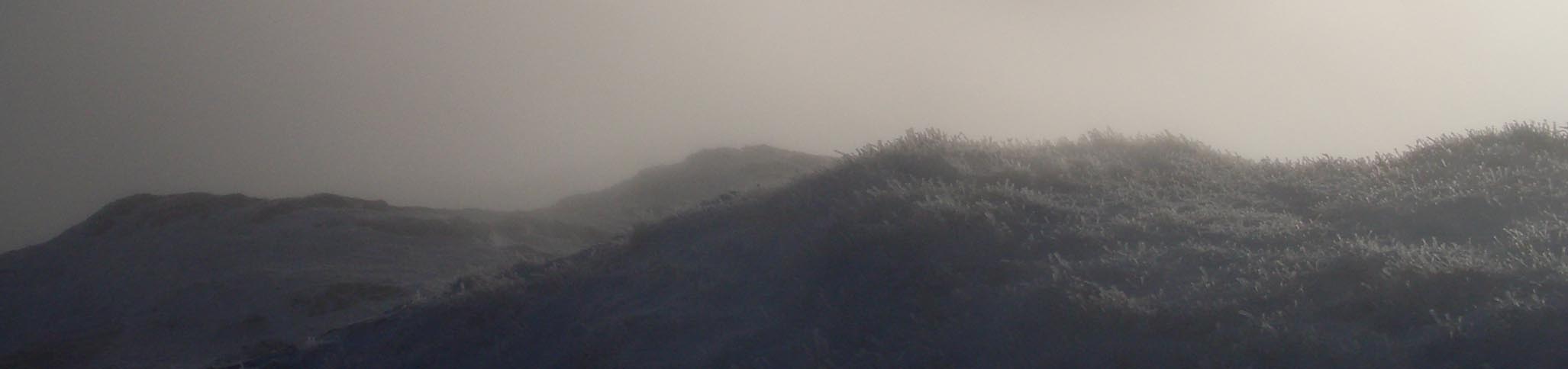
 Weather/Conditions: Overcast at the bottom and cloud was at 2000 feet. So upper reaches of the mountains were in mist, however the summits were just appearing through the clouds. Snow was above 2000 feet and rather thick on the summits, but underfoot, there was incredibly minimal ice, which was a bonus. there was also very fine icy falling, meaning everything that was exposed was covered in a fine dusting of ice. Wind was minimal, but was
stronger on the summit of Ime and back down to Arrochar.
Weather/Conditions: Overcast at the bottom and cloud was at 2000 feet. So upper reaches of the mountains were in mist, however the summits were just appearing through the clouds. Snow was above 2000 feet and rather thick on the summits, but underfoot, there was incredibly minimal ice, which was a bonus. there was also very fine icy falling, meaning everything that was exposed was covered in a fine dusting of ice. Wind was minimal, but was
stronger on the summit of Ime and back down to Arrochar.
Distance/Ascent/Time: 10km / 930m / 5h 35m
Accompanying: Dave "Dink" Macmorris
Ascent of Luibhean
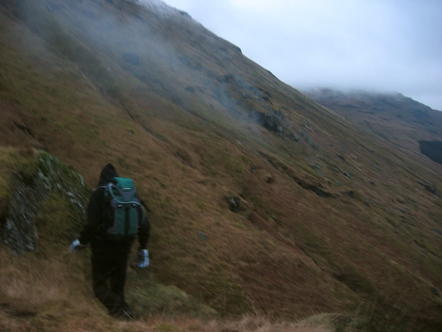
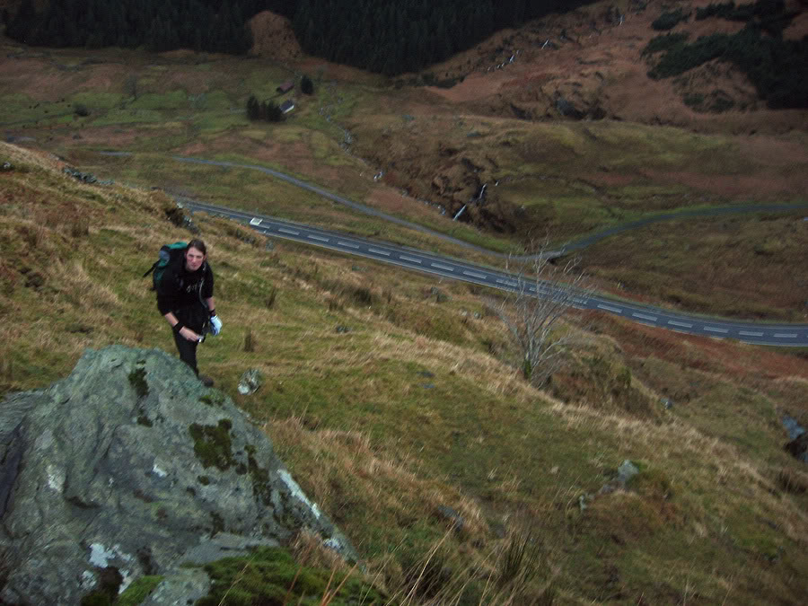
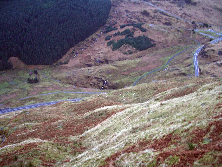
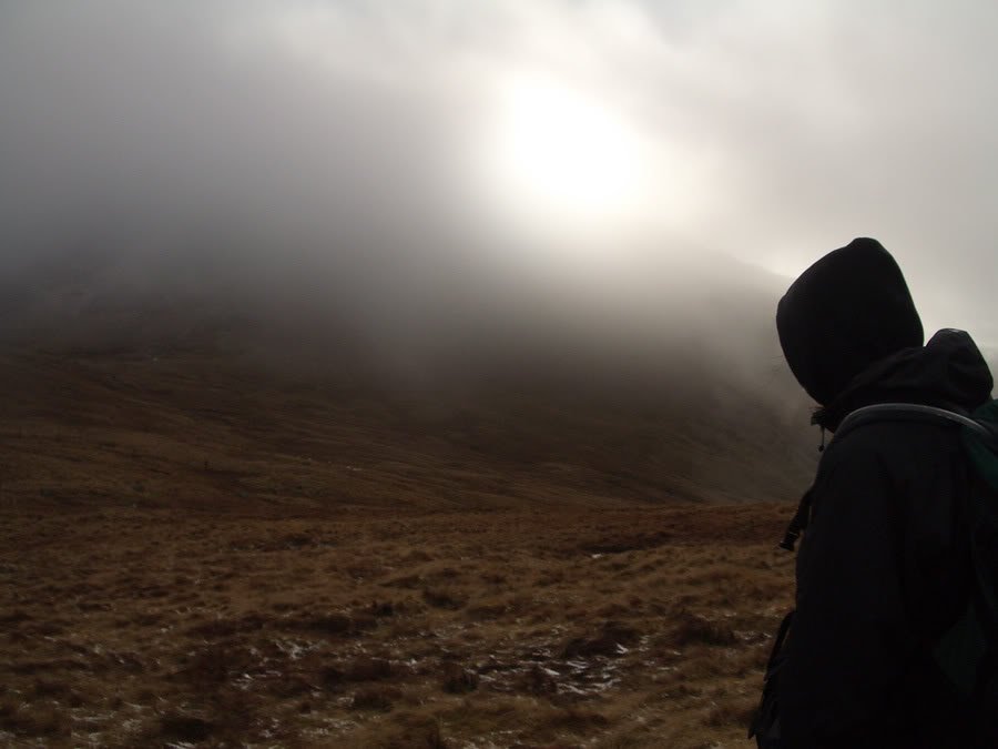
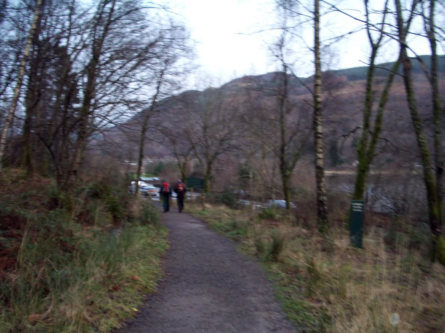
We started 9.20am. To get to the top of Beinn Luibhean as safely as possible we'd need to contour around the side and then approach from the south, which I knew from seeing the mountain before could be done safely. Initially there were a lot of bogs, and a lot of rivers to cross. Everything on the way to the summit was to be over rough terrain, so the going was slow. The slopes were also steep, and we headed in a diagonal upwards, gaining height and horizontal distance together. The side was covered in small streams that we'd have to walk around, carefully to, and then jump across and then continue. It was a tedious process where we were certainly being required to earn every inch of our ascent. The slopes were also very steep, so care was required, but I wasn't concerned in the slightest really. There was one point where I sort of realised that a fall would have grave consequences as I was about to make an uncertain move over a rock, but I went back and took a safer route across. The slopes were just grassy, not too wet, so everything felt positive. I just wanted to make some headway, and get somewhere instead of battling our way past the lower slopes. Although after a while, the ground began to flatten out. Above us, cloud obscured most of the snow, although we could see some.

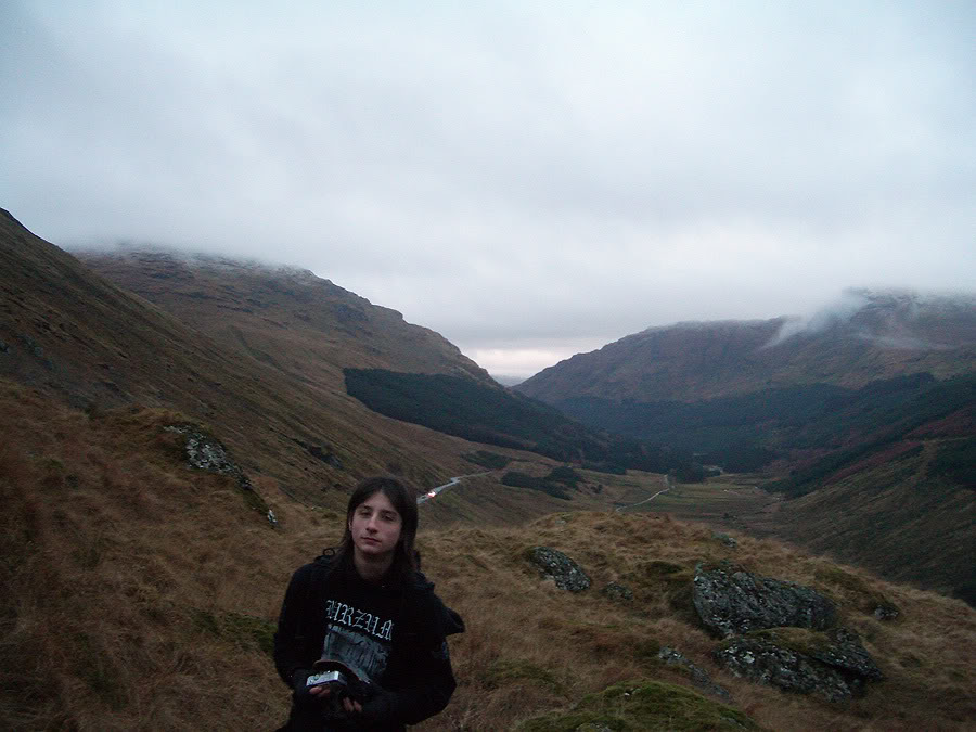
We stood on a flat section, essentially a bog in places, and a small corrie was off to our left. I wasn't keen on going straight up there, because there was a chance then we'd get into trouble (although it was a direct way to get to the summit). In front of us was the ridge, and to get up required a sharp ascent up steep slopes, yet once we were up there, I was confident we'd be clear to head straight for the summit. We began pacing ourselves, and slowly worked our way up the side. We gained a lot of height quickly but it was a hard push. We got onto the ridge, and were now just below the cloud base.
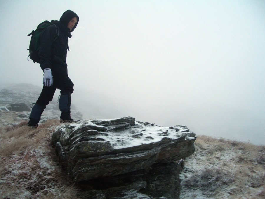
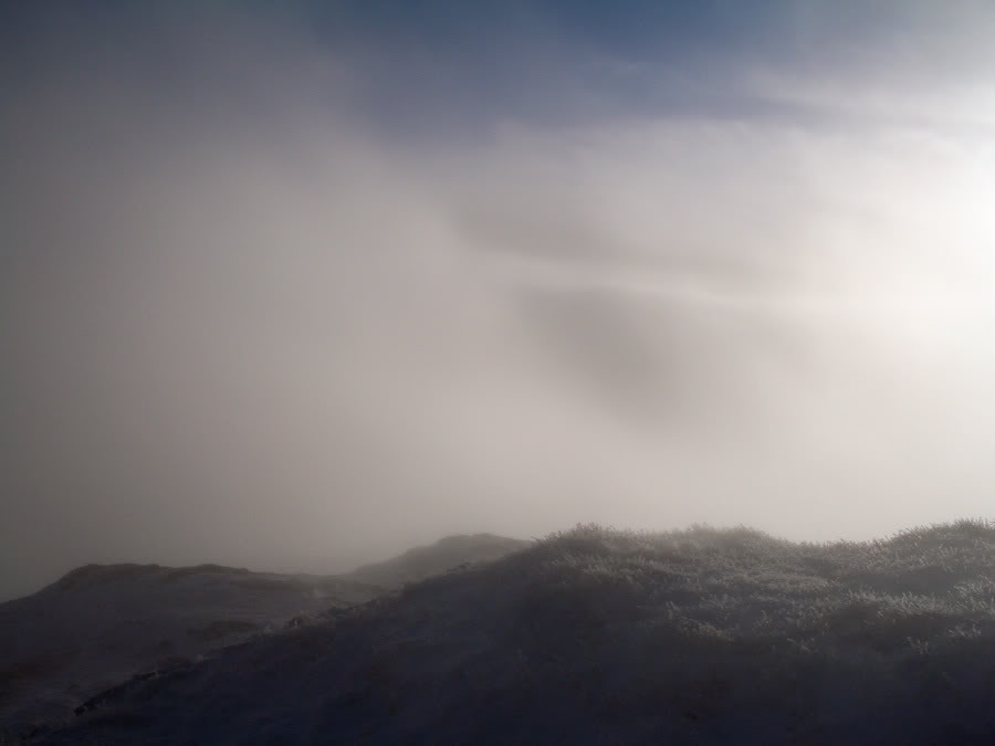
We found ourselves on a flat piece of ground, and decided to take our first real break. I could see clearly up the first section of the ridge now and there was a substantial amount of snow lying above. Dink put gaiters on, and I put more layers on, as we were about to being the higher reaches of the mountain. We were at 2000 feet already and only had a bit to go until we hit the summit. Even though I had never been in these conditions before, everything was working, the summit was where I expected it to be on the GPS and there was no ice lying around. I was completely comfortable with what we were doing (asides wondering if Dinks mum had found out what we were up to) so after a short break we continued on upwards. The visibility was low, but the summit felt nearer and we pushed hard to get up. I was using my ice axe primarily as a trekking pole, but it worked excellently at that. The cloud was down, there was snow everywhere and the whole world was shades of grey, but we pressed on, and I was rather excited about summiting.

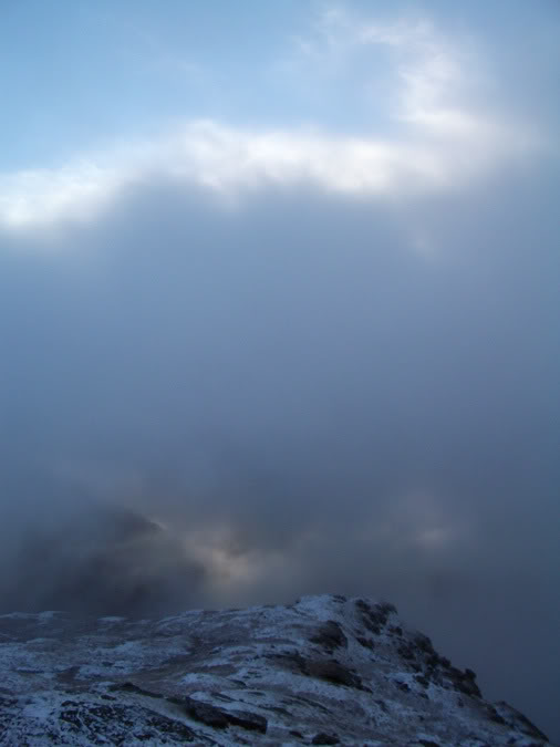
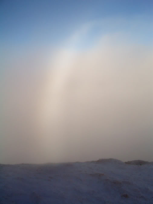
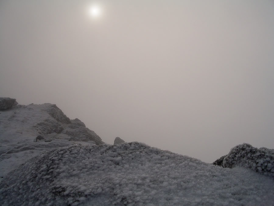
At 11.25am, we finally got there. The summit was semi-out of the clouds, so the conditions were a bit odd. Still, it was very peaceful there. The sun, low in the sky, was shining through thin clouds and cast long shadows along the wind carved snow. There was almost no wind, and there were hints of blue sky. There was a great sun-halo beside us and fine ice particles were being swirled through the air. It was quiet, and very magical. Very peaceful, so we stayed for a while.
We couldn't see Ime however, and I knew very little about where it actually was. My GPS wasn't being too reliable only because it had lost its sense of direction because we had stopped walking, so I brought out the old map and compass, and worked out exactly where Ime was, and where we should go to get down to the bealach between Ime and Luibhean.

Beinn Ime
We left the summit after about ten minutes there, and began walking down. Although I had my axe, the snow was just right for walking on, and the descent was straightforward. There was one point where we were descending towards cliffs, so we backtracked, and found a safe route. We passed two people and their dogs, and I fell at one point, landing on a rock with my right shoulder. Dink, in turn laughed, which pissed me off slightly. Never mind though.
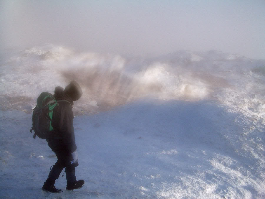
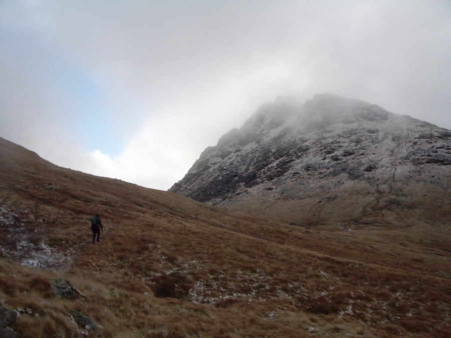
There was no snow at the bealach, and it was very boggy. We were going to just head straight up the side of Beinn Ime, and hit the top. Once again, there was no path but the GPS did me wonders and I had the route up to the summit already marked in. Avoiding crags on the way, we slogged our way up the side. The snow thickened again and we found ourselves in cloud. Still, everything was going just to plan, and I knew exactly where I was. Under the snow, only buttery-cream coloured grasses showed through and the ground had a funny look to it.

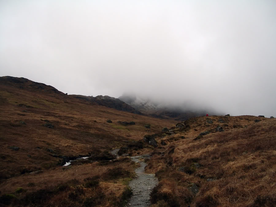
After one final steep slog up the mountainside, we came to the path, and through the mist, I could see the bump that made up the small summit to the east of Ime’s real summit. it was then I realised with quiet relief how close we were. The altimeter was agreeing with me on that one, and it was a short walk up the path to where the summit was.
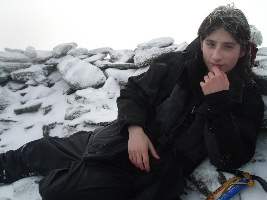
We reached the top of Ime at 12.55pm. The summit, minus the snow and lack of views was just how I remembered it: very airy! In fact, up here I didn't feel attached to the world at all. It wasn't the same as the serenity of Luibheans' summit. Lumps of clouds flew by our heads, and the planet earth beyond these few square metres felt almost non-existent. It was just how I remembered it, certainly...
Descent
We stayed for a small while, but there wasn't much else to do, so after a while we left, and began the descent with wet feet and sore legs, back to Arrochar! This was going to be one painful descent, and I don't think either of us was particularly excited about it.

We reached the Bealach a' Mhaim at 1.35pm and went back via the path between the Cobbler and Beinn Narnain. The only reason we had to get back to Arrochar was that we needed a phone, and we didn't have any signal. So the gruelling descent was taking its toll, and I stopped at the Narnain boulders. I took some waterproofs off, ate some more food, and really felt the difference once we started, my energy had actually gone suddenly upwards. Still, my feet and legs were screaming at me, and we just took the descent as it came. It wasn't terribly nice, but we got off the hills at 2.55pm.
We arrived at the Ben Arthur Bothy (as is usual!) ten minutes later. I phoned mum to give us a lift back to Glasgow, and I had cod and chips in the meantime. Mum arrived just over an hour later and we got back to Glasgow at about 5pm.
As I sit here the night after, my feet have been aching all day and my shoulder still hurts from where I fell. Still, all in all, a very enjoyable hillwalk, and it boosted my navigational confidence many times over. The snow and ice was exciting, the off-road aspect was thrilling at times - I learnt a lot from this hillwalk.

Written: 2007-12-30