Beinn Nuis (top) – 792m
Beinn Tarsuinn – 826m
Beinn a' Chliabhain – 675m
Saturday 19th July 2008
Beinn Tarsuinn – 826m
Beinn a' Chliabhain – 675m
Saturday 19th July 2008
 Weather/Conditions: Sunny with some cumulus the whole day. A fair amount of wind but it was otherwise as good a day as they get.
Accompanying: Solo
Beinn Nuis
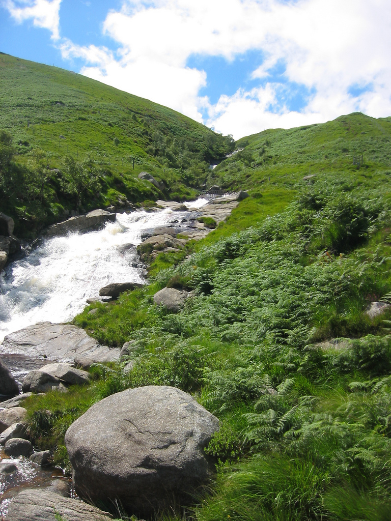
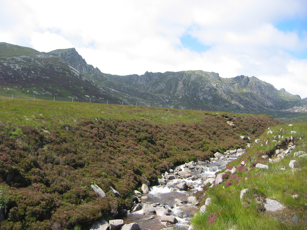
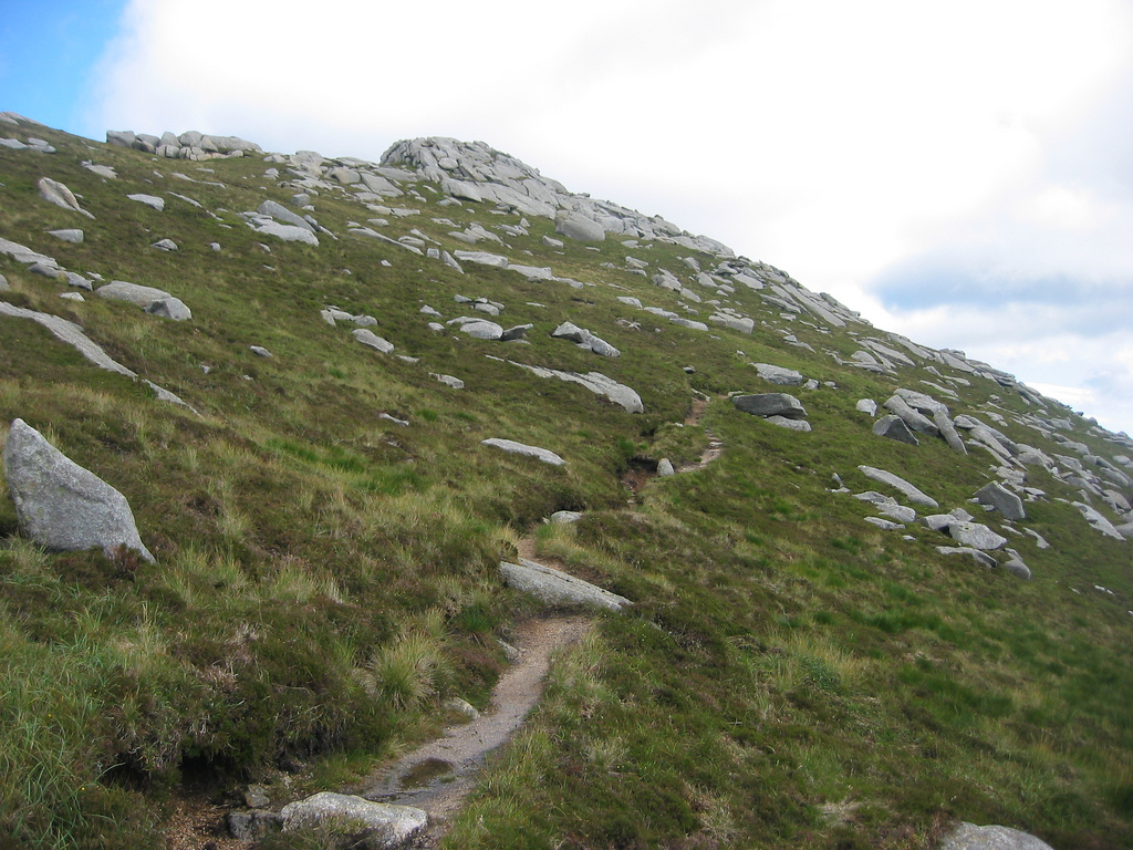
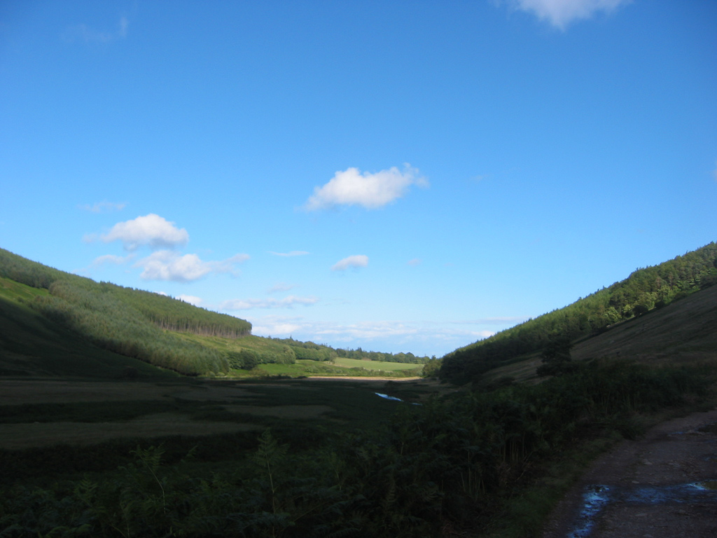
I began walking at the Glen Rosa campsite at 1.05pm and followed the track into Glen Rosa. Beinn Nuis sat above on the skyline and to get there I'd have to turn off by the Garbh Allt, a wild and fast flowing river. It didn't look so significant from the map however and I brought the map out locate the turn off. Once I found the path, it was clear enough. It wound its way up the hillside where I trudged up through long grasses and wet ground - the kind of place you don't want to be in hot weather. The Garbh Allt itself was impressive and far greater in size and volume than the map suggested. I guess 'Garbh Allt' ('Rough River') gives it away.


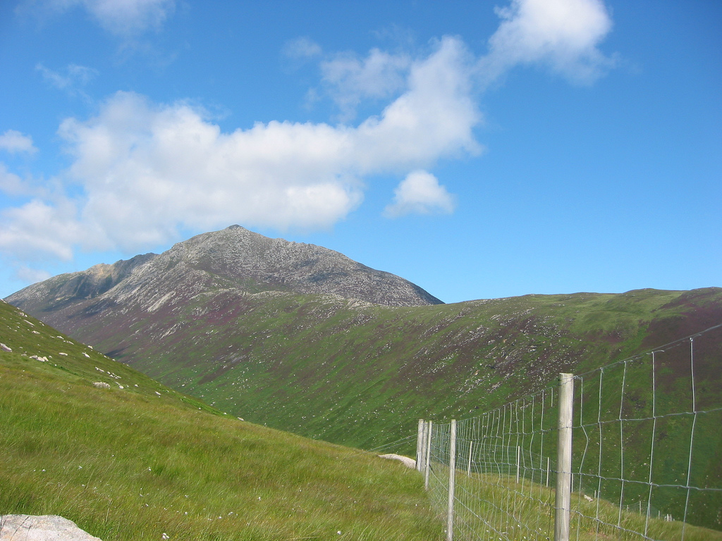

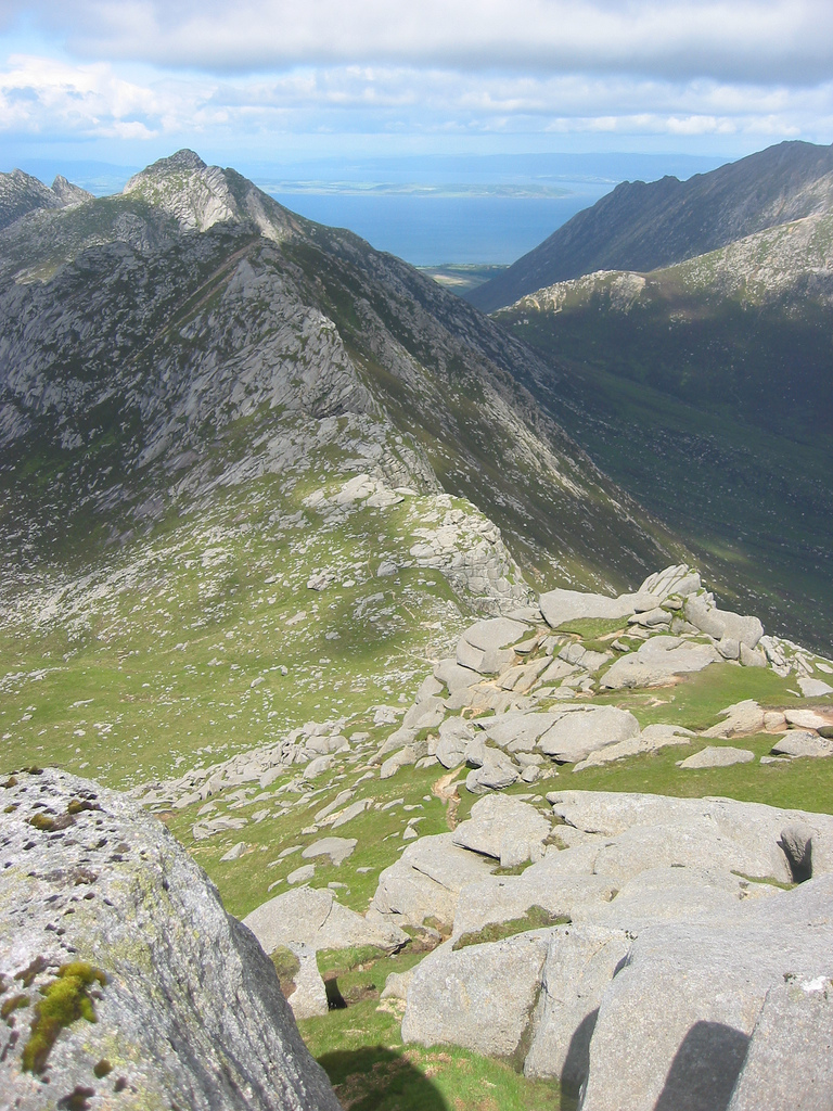
The path opened up onto moorland where I subsequently began plodding over bog and grass, losing it along the way and going off road. Getting past fences and river crossing presented minor problems, but walking in the general direction of Beinn Nuis brought me back to the path by which time I was fairly high up. From here it was a little cooler and the top of Beinn Nuis was just above. I walked around its SE shoulder where the path was easy enough to follow – there was just some scrambling and the exposure would increase with height. I'd hoped my scrambling abilities were improving because despite the great drops here and there it was all easy enough. Before long I was standing top of Beinn Nuis, where a small cairn marked its jagged top.
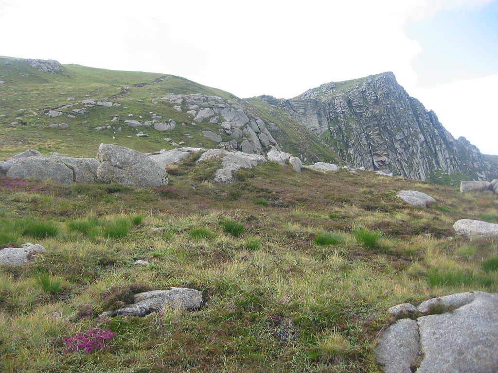
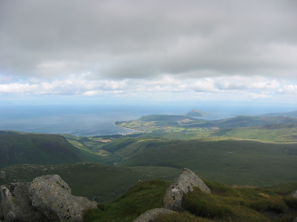
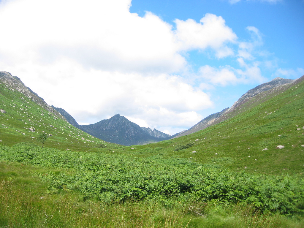
Ridge to Beinn Tarsuinn
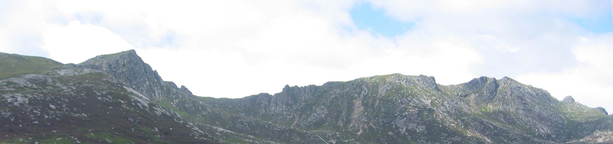
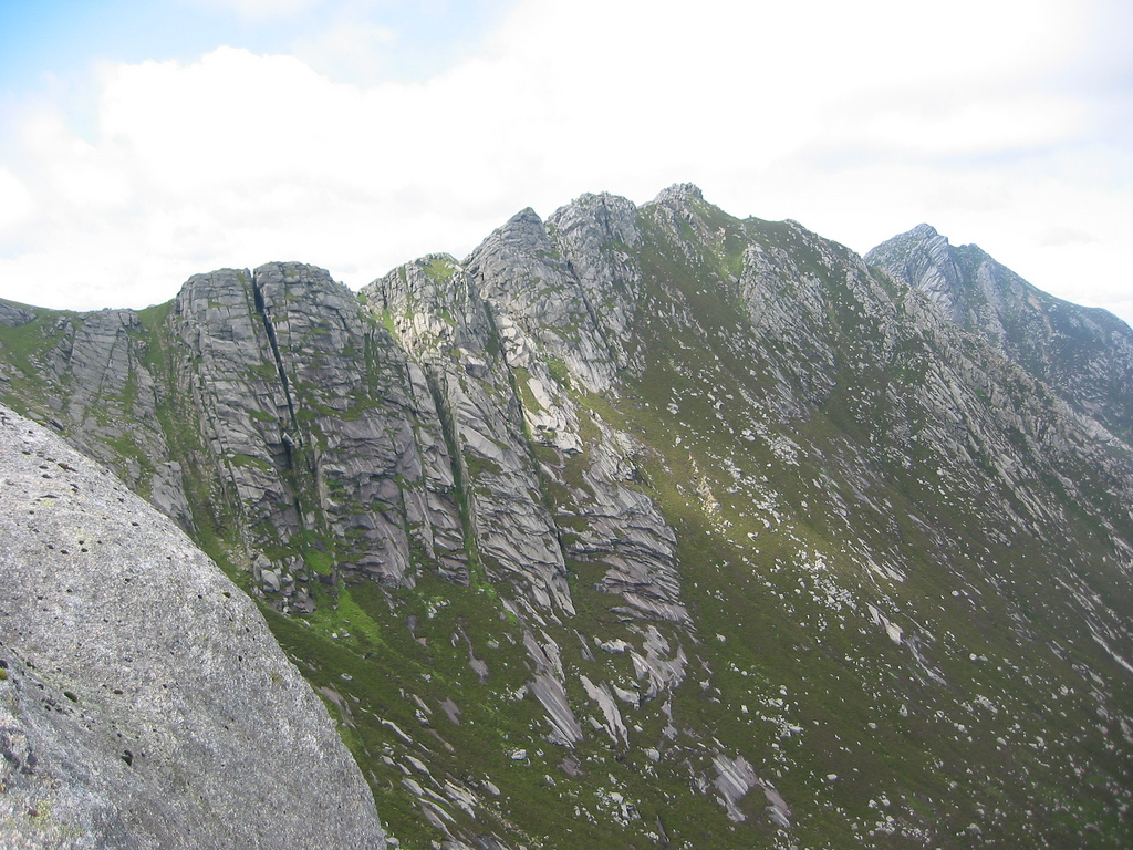
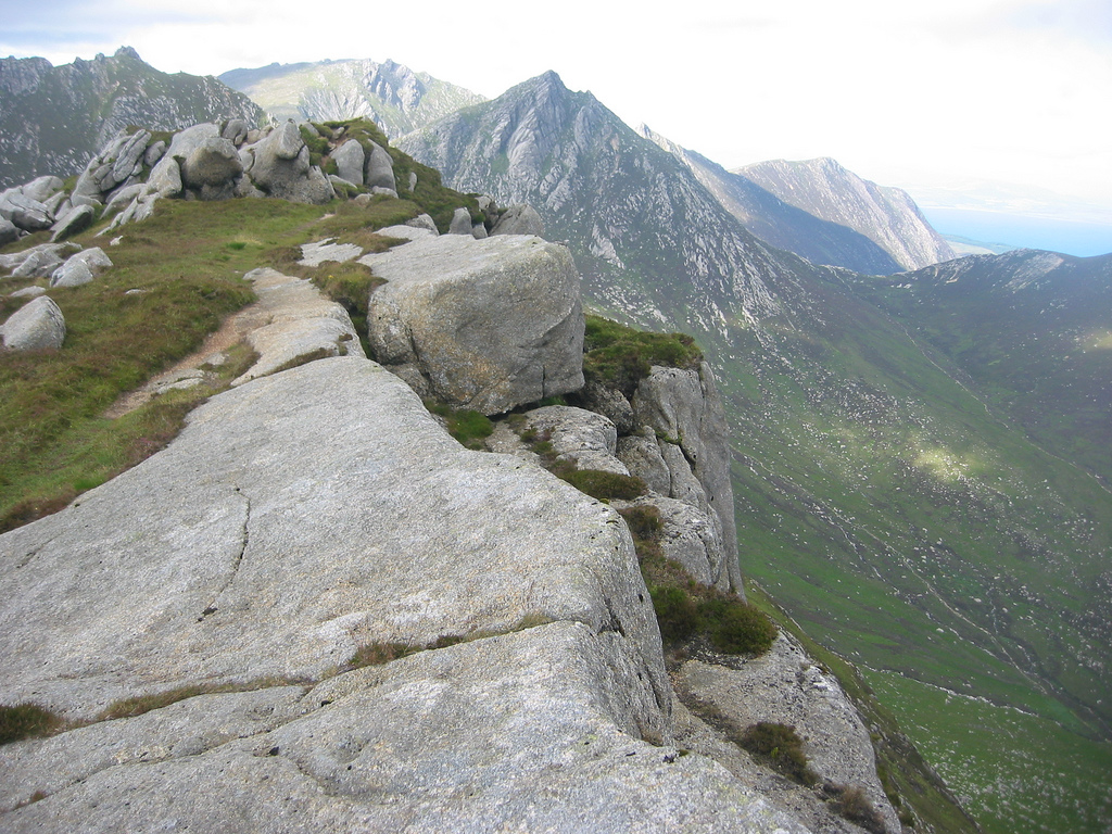
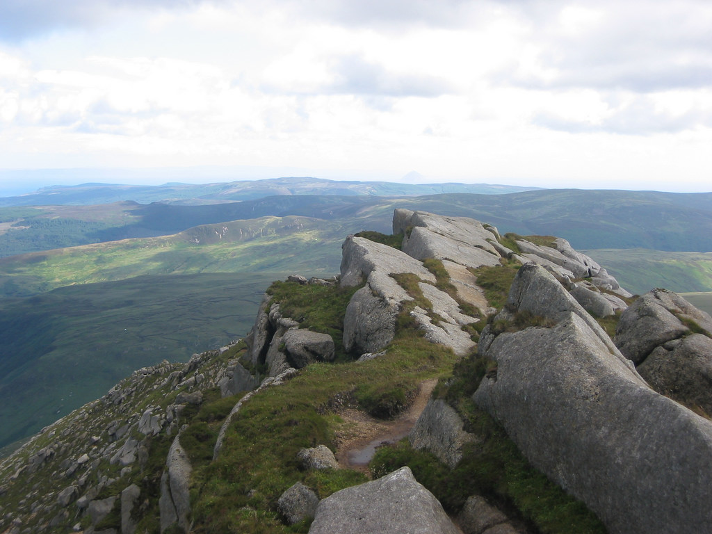
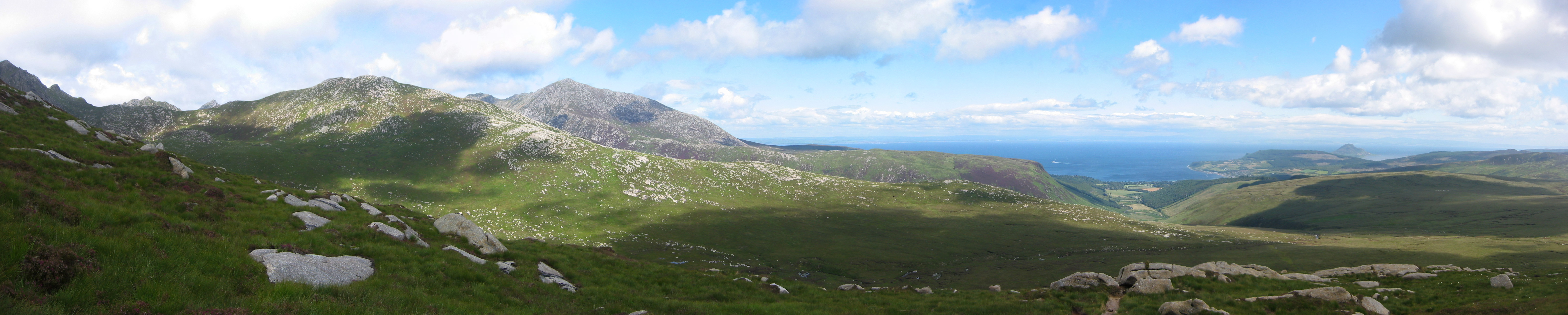
Beinn Nuis is a top of Beinn Tarsuinn though from the east it has greater form than it's higher Corbett. Beinn Tarsuinn is a mountains that is hard to get a good photo of. Being on top of Beinn Nuis with views north to Tarsuinn meant I could, for the first time, see what lay ahead. There was going to be some scrambling but not terribly much by the looks of things. There was a good strong wind coming from the west but it wasn't enough to create loss of balance. I felt positive about going on ahead.
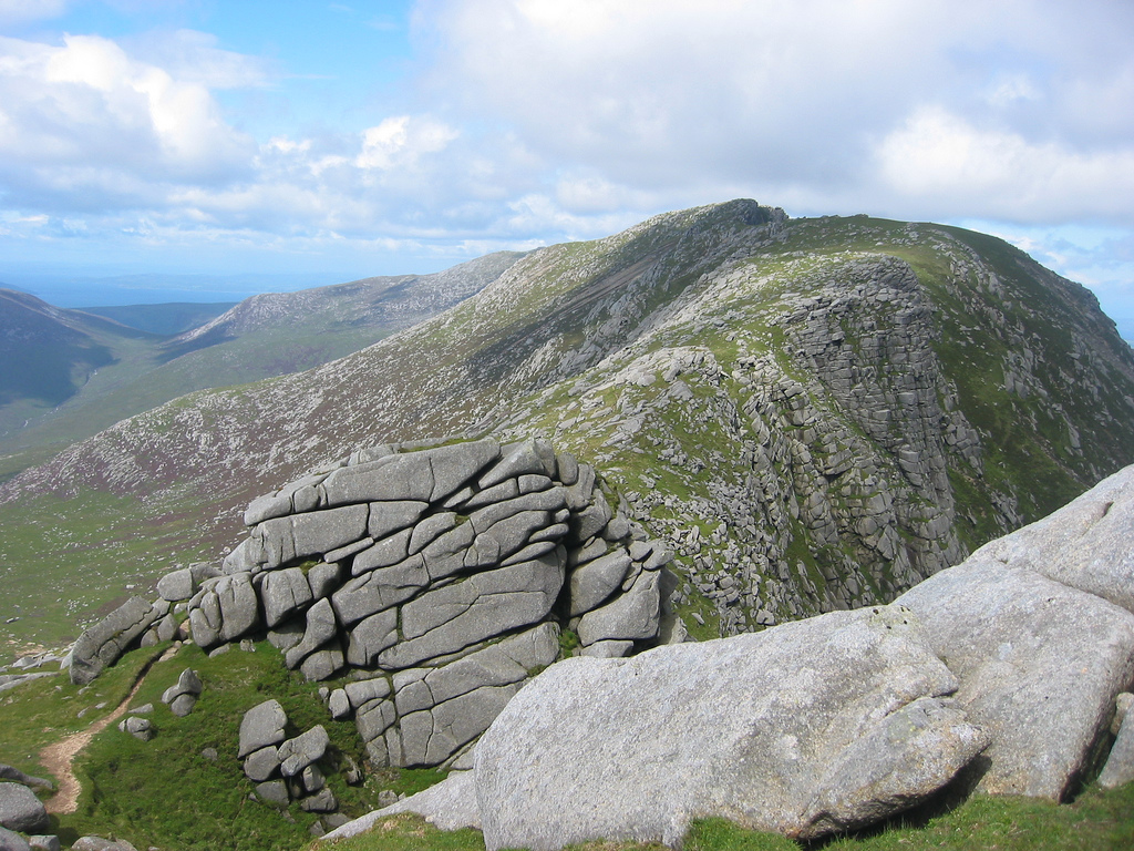
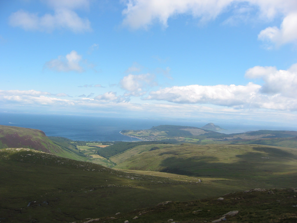
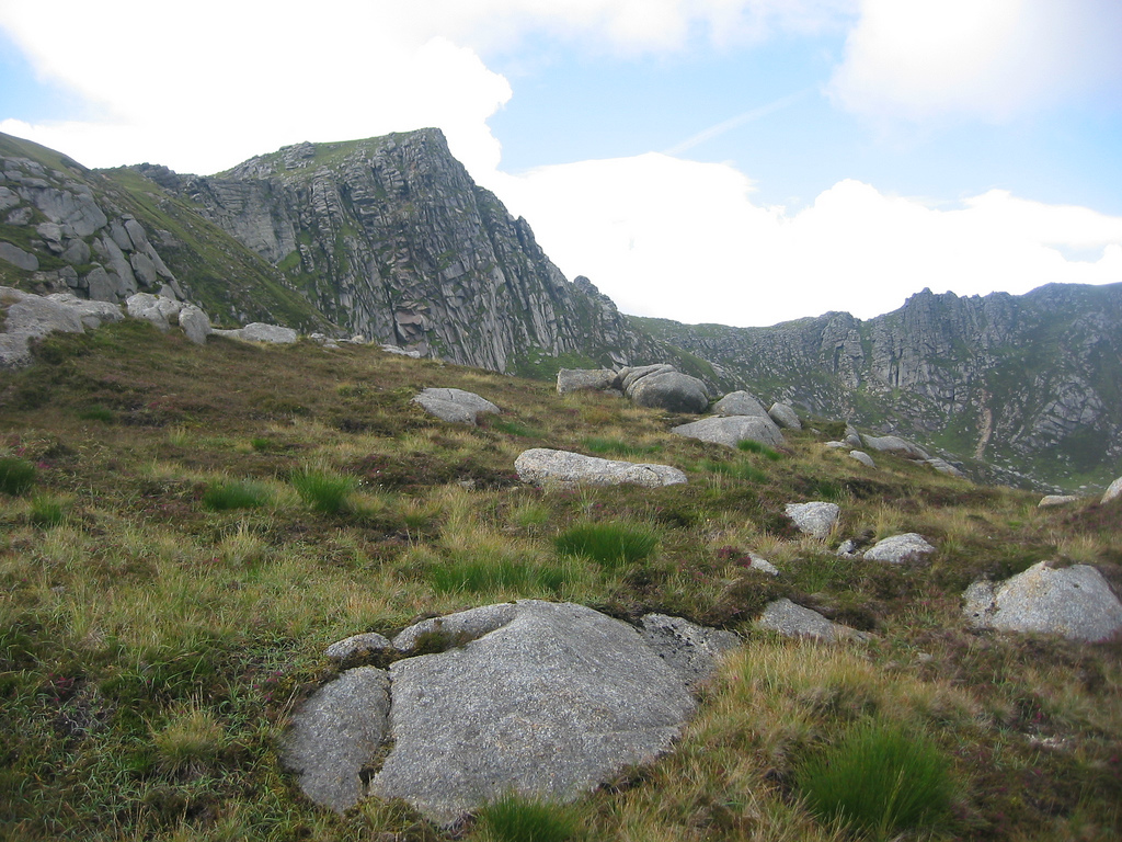
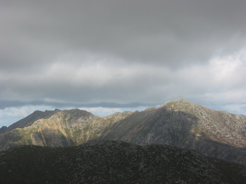
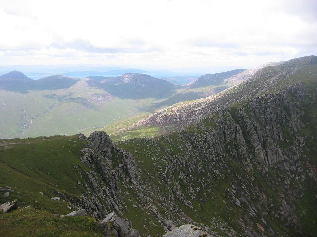
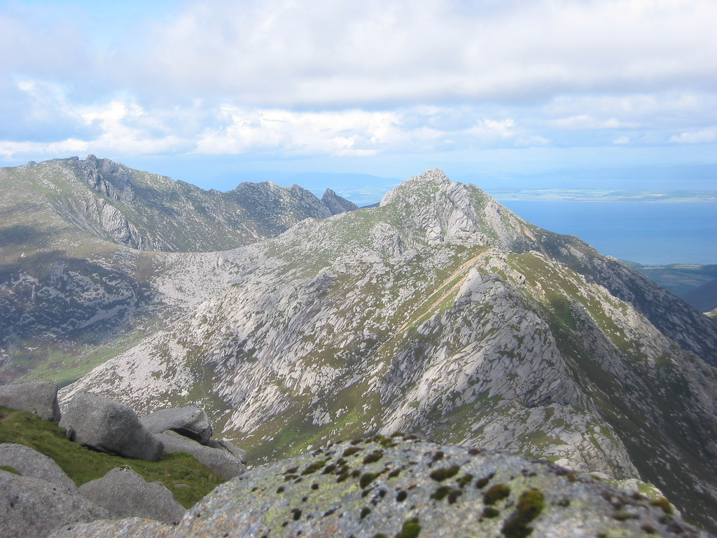
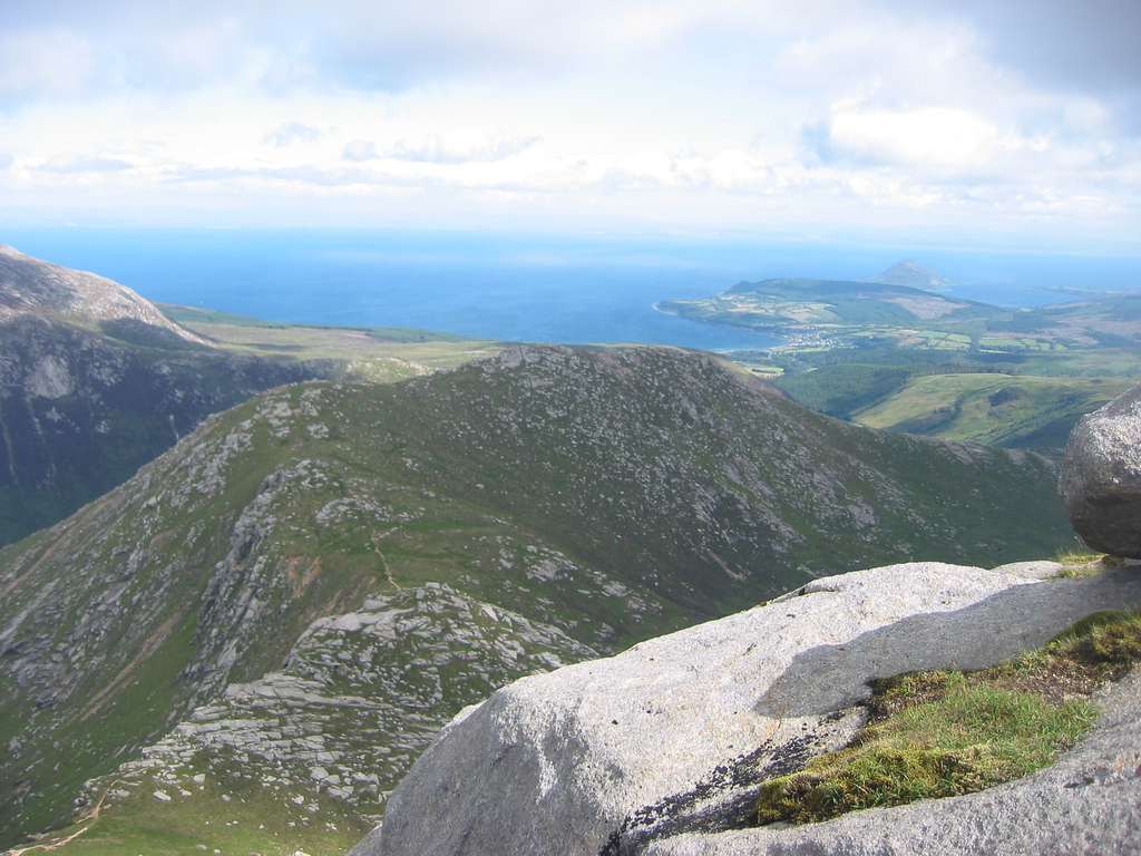
The views across the rest of the range were superb – as always in this corner of Arran. There was quite a lot of scrambling in the end but it was all pretty easy and certainly within my capabilities. There were exposed bits but everything turned out to be avoidable. This was good for me for the western shoulder dropped off less than the east and while I was walking by cliffs, essentially, I could still have a good time without being scared senseless by exposure, drops or whatever else. Before long I'd gained a lot of horizontal distance and Beinn Nuis was a long way off. It came as quite a shock I'd made so much progress along this ridge and I couldn't be far off the top of Beinn Tarsuinn.
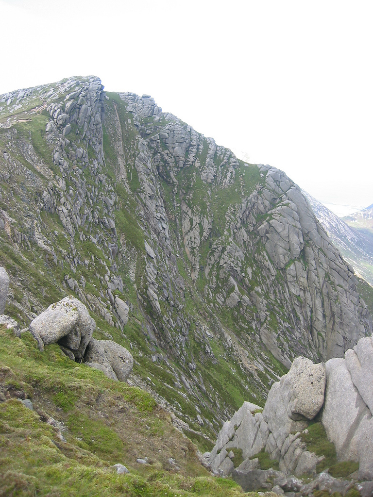
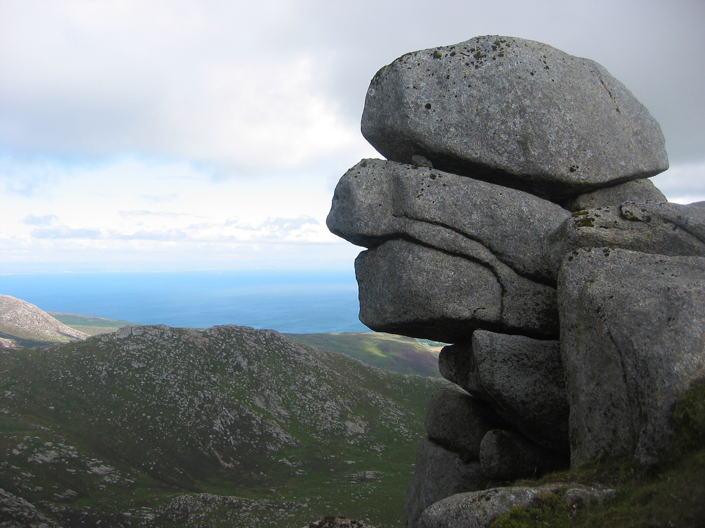
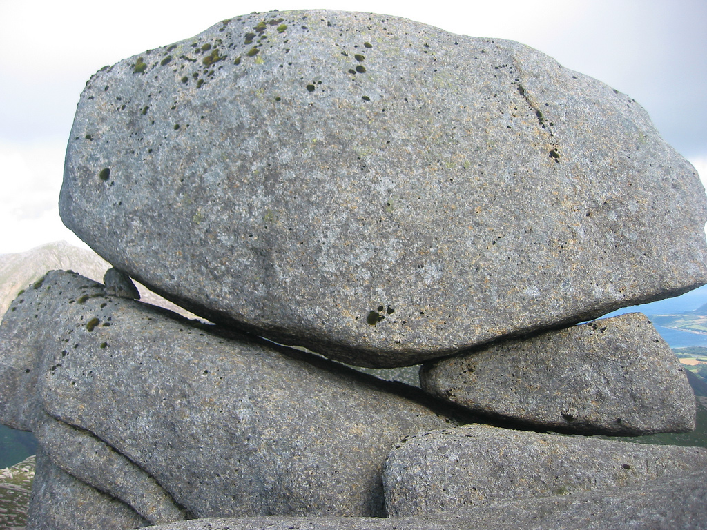
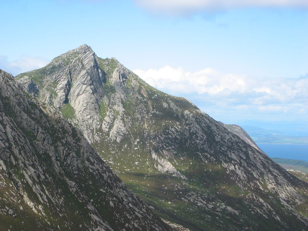
But what really added interest was the moment I came across the Old Man of Tarsuinn. I hadn't ever heard about this rock feature before and I'd always thought finding faces in rock was a bit desperate. But this really looked like a face in the rocks so I paused to take pictures. It was a surprise - a proper face! Check pictures... Before the summit it was an easy walk along an easy path although with one hell of a drop to the right. Although it had the simplicity of being the technically easiest section on the ridge, the drop made it a place where a small trip would send you hurtling down several hundred feet. In other words it called for some concentration. Only brief concentration – a few moments later I was on top of Beinn Tarsuinn. I took pictures and there was a strong wind, so no need to stay around for long. The summit has two tops, both seeming to be the same height as one another. I took a panorama from the north top, where the south top looks higher. Unsurprisingly, the north top looked higher from the south. Anyway... onwards...
Beinn a' Chliabhain
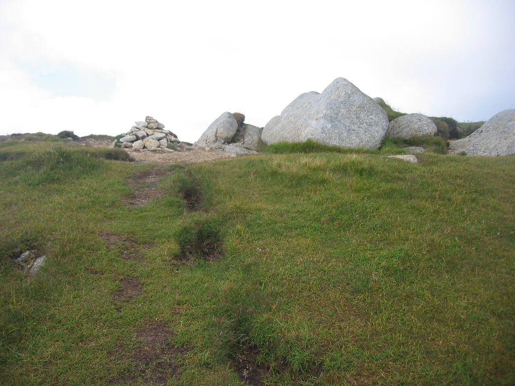
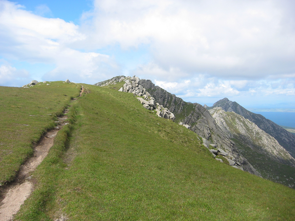
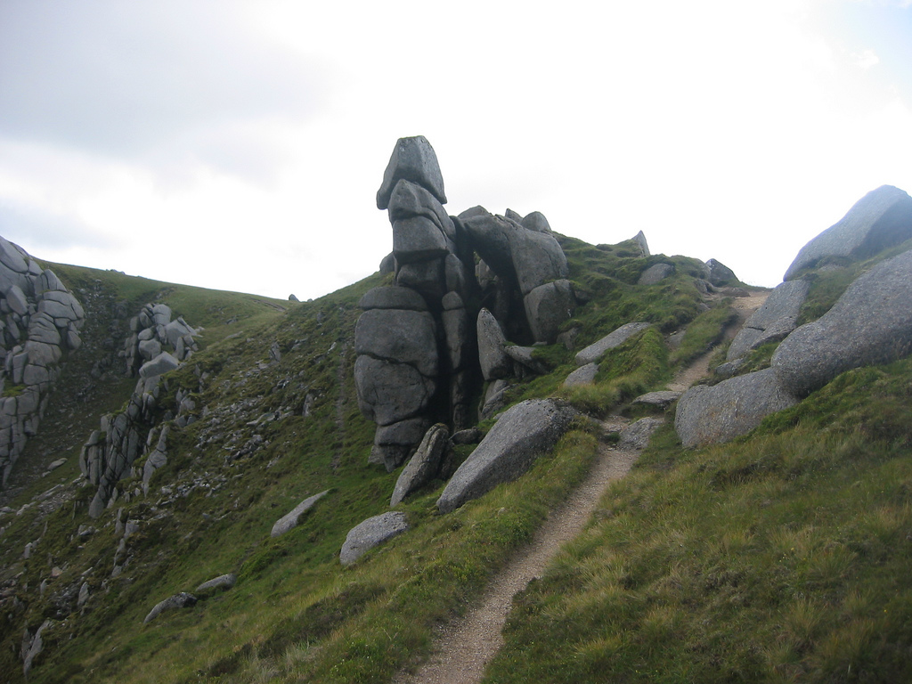
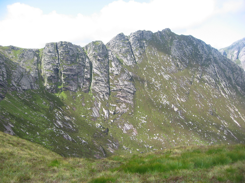
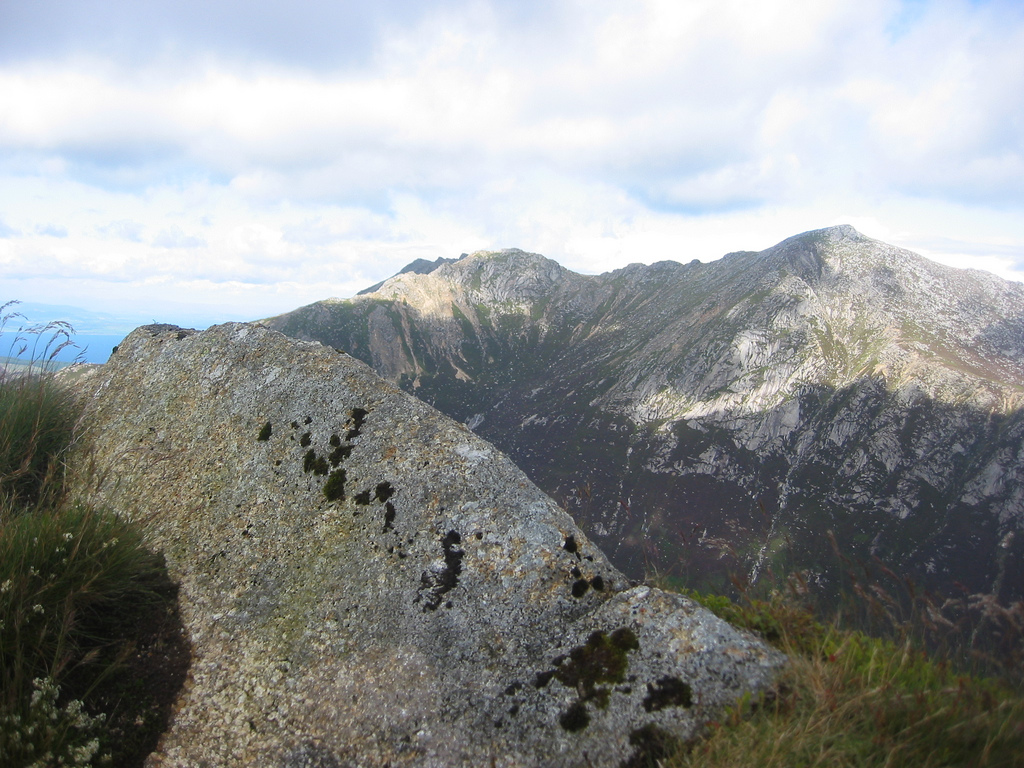
Descending the northern ridge involved a lot of scrambling and at some point I'd hoped to turn off and take the ridge leading up to Beinn a' Chliabhain. In the midst of scrambling I went too far and reascended to get to the ridge to Chliabhain.
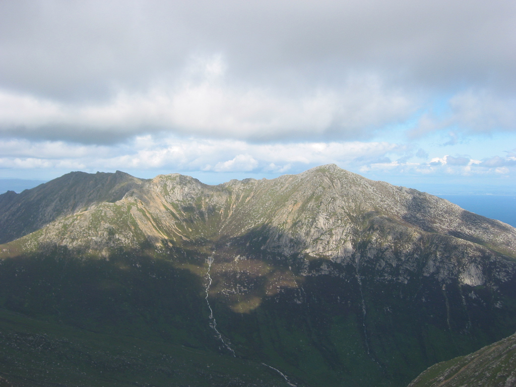
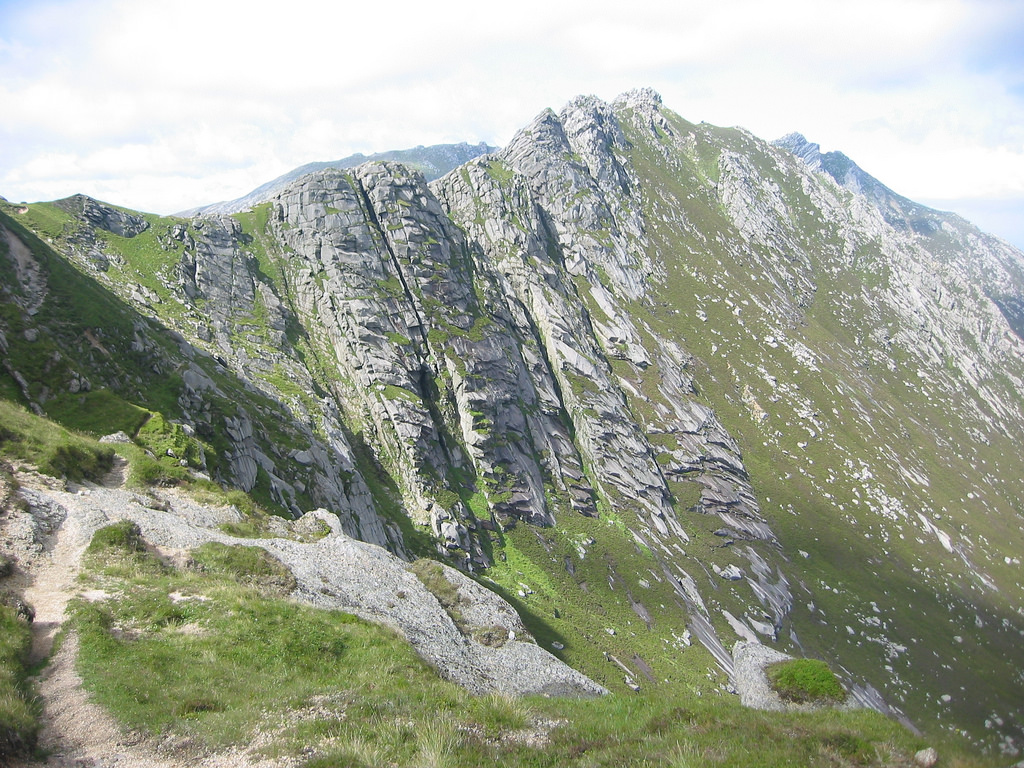

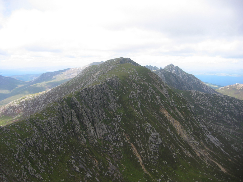
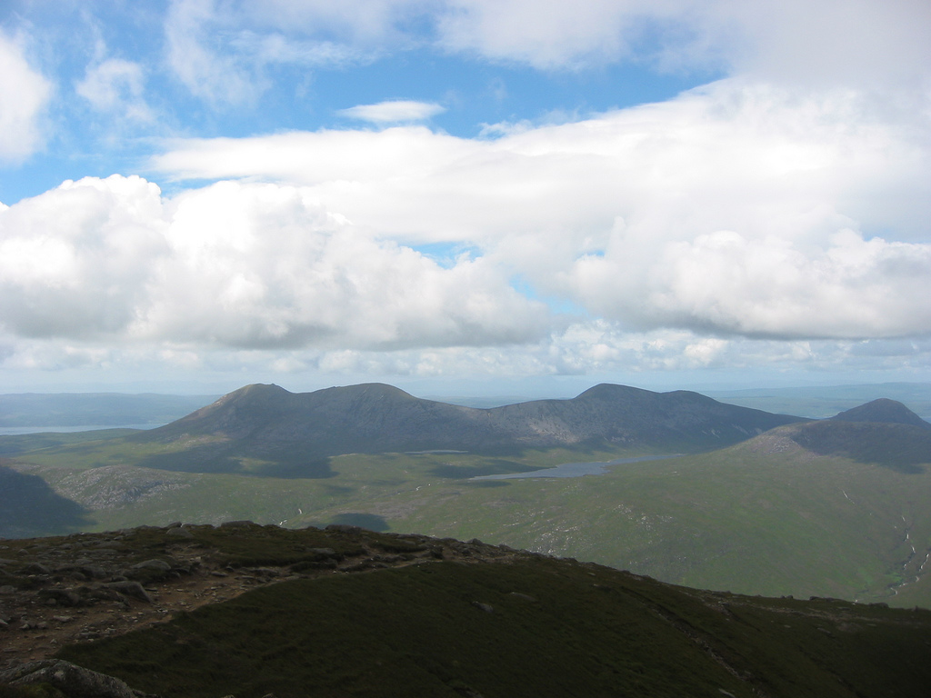
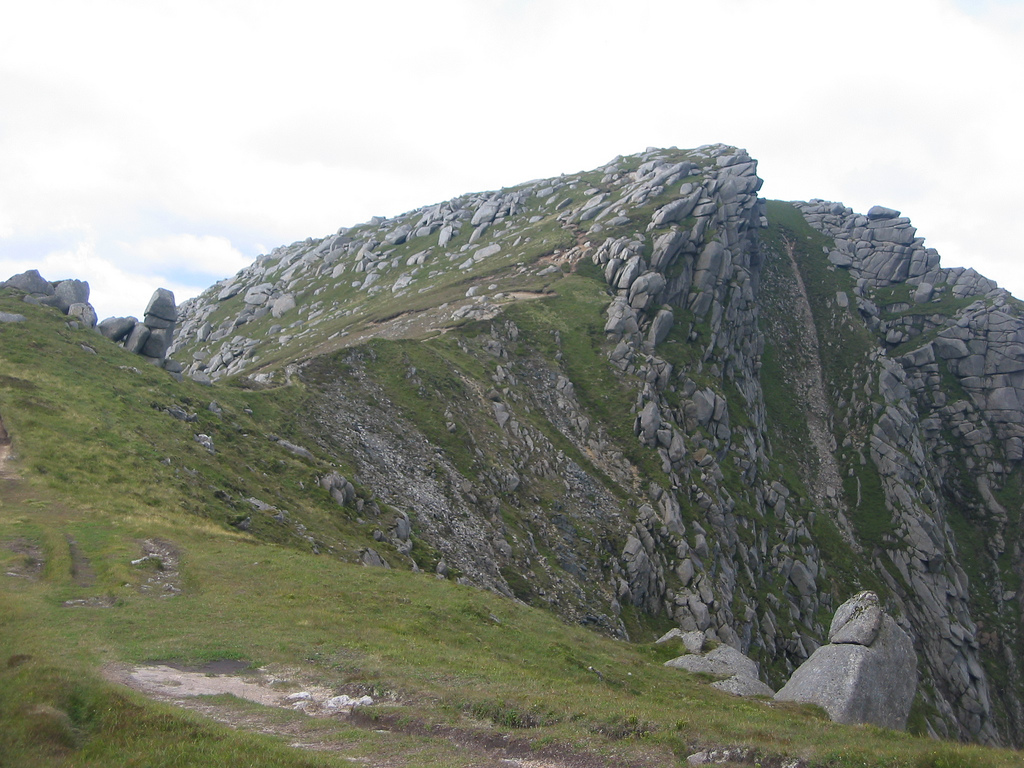
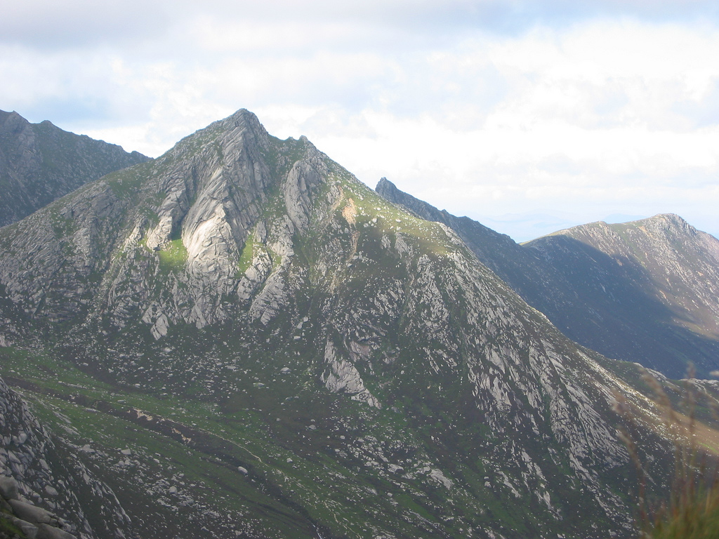
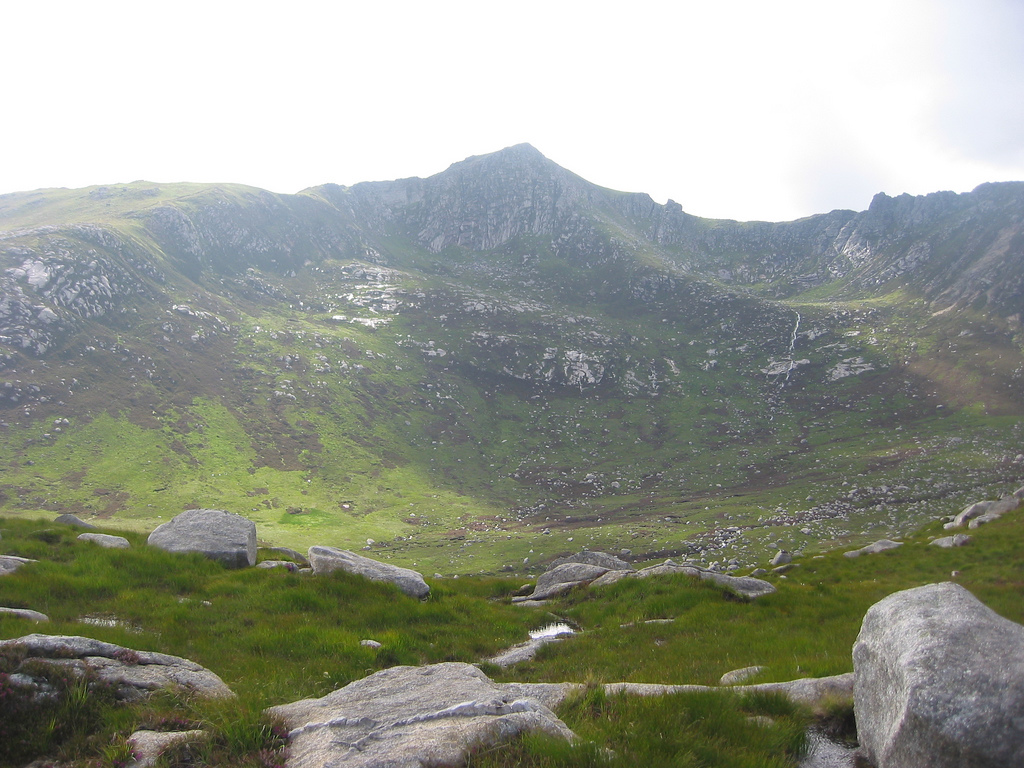
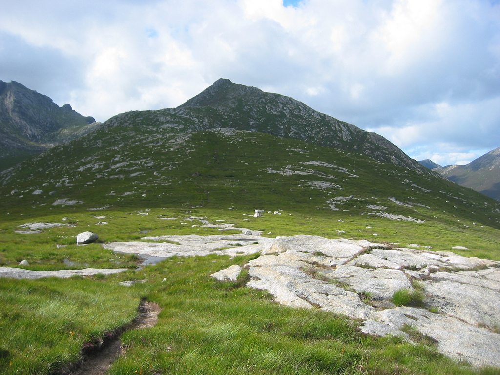
Once I was on the ridge it was easy going and I followed the path around the west side of Chliabhain aiming to go to the far end of the ridge – I wasn't totally sure where the top was. After a little scrambling and more wind I arrived at the crest of the ridge, although not at the summit. I'd overshot and had to follow the ridge back a couple of hundred paces to get to the real summit. The eastern slopes dropped spectacularly down to the valley floor of Glen Rosa and the western slopes were almost as steep. Though the ridge gave a lot of scrambling, I subsequently found out it wasn't too difficult either. It was enough to keep me happy but all the same I had a choice of whether I wanted exposure or not. All the same, standing with the drop to Glen Rosa a few inches from the tips of my toes made me tremble ... I don't think I was built for heights but of course most people aren't either.
I took the time at the top to actually sit for once and really enjoy the views - I was aware that I never really do that. There's the odd occasion I love to sit at the top on a nice day and have lunch or something but in general I get to one summit and continue onto the next. So here I'd sit for a while and just enjoy myself simply for where I was. There was still a strong wind which held up for a while then in an instant dropped totally. However hard the wind blew though, I was happy where I was. I ate a bit, took a panorama and other various pictures before deciding to leave. After the plans I'd made with parents I still had three hours to get back to Brodick so I was in no rush whatsoever. And dammit, I was really enjoying myself – exactly what it's about. :)
Descent
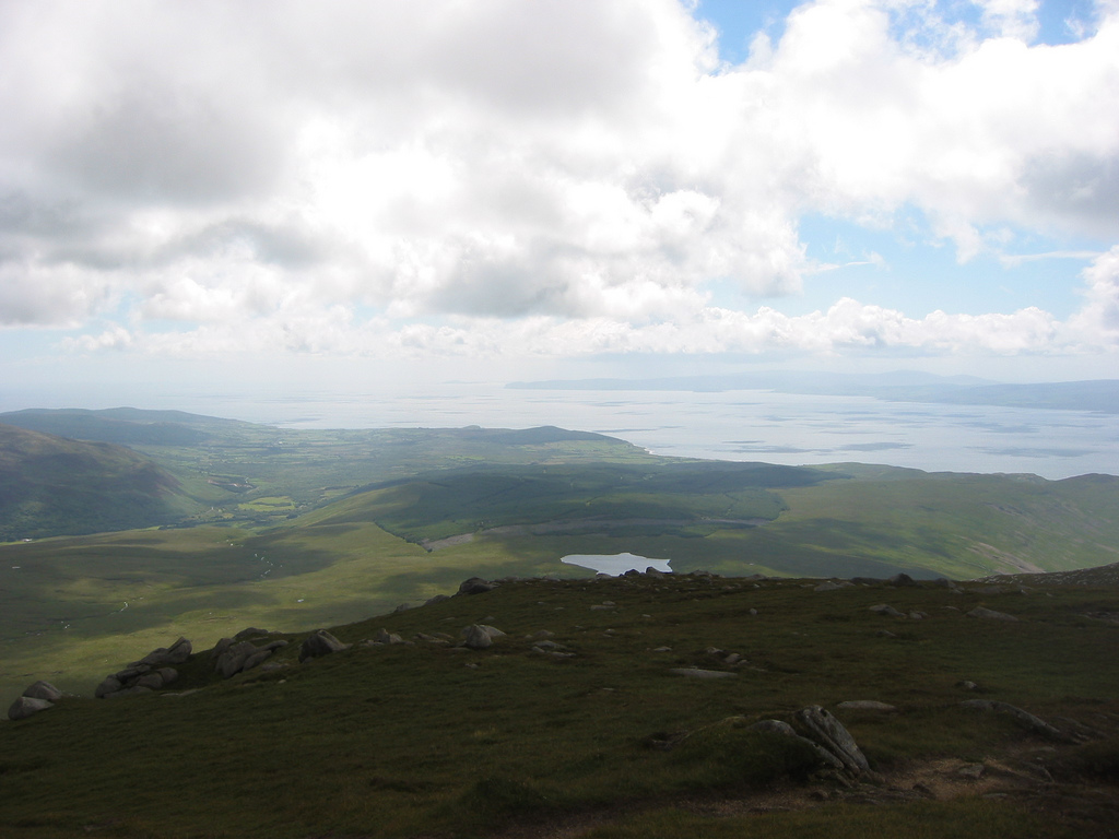
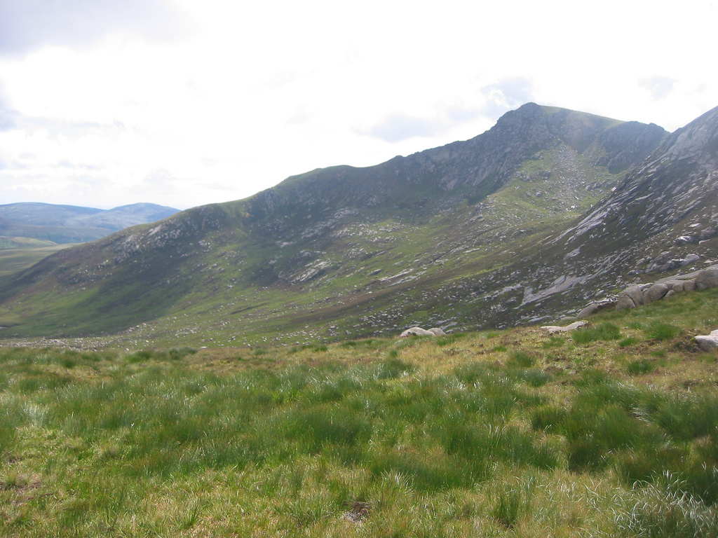
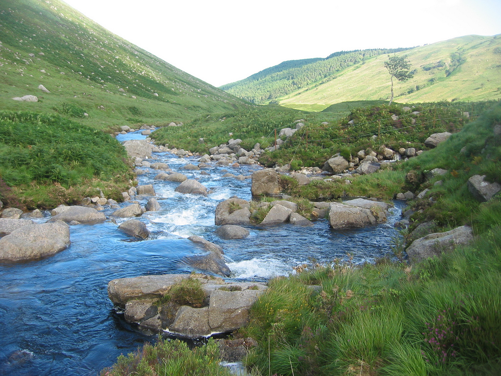
When I left, it was an enjoyable walk down side the southern shoulder of Chliabhain and that eventually gave way to wide and sometimes boggy slopes. This late in the day I wasn't very bothered about wet feet and took any old route down. Eventually I met up with the Garbh Allt and descended to Glen Rosa. Currently, it was around 5.30pm and I was meant to be meeting back at the Glen Rosa campsite at 7pm. I had a lot of time to spare and my phone didn't get signal, so I went down to the river and sat for a good ten minutes or so, just relaxing...


However, my phone did work down here although I mustn't have noticed. I received a call from the parents and we changed the meeting time. Continuing walking, I kept a good pace and was back at the campsite right on 6pm. Beinn Tarsuinn was one of my better days and possibly my best for a while. I felt in great spirits the whole way and the weather also played ball that day. Superb.

360° Panoramas
Beinn Nuis, looking NE

Beinn Tarsuinn - 360˚

Beinn a' Chliabhain - 360˚
Times (Time relative to 0.00)
(0.00) 1.05pm Glen Rosa campsite
(1.55) 3.00pm Beinn Nuis
(2.25) 3.30pm Beinn Tarsuinn
(3.05) 4.10pm Beinn a' Chliabhain
(4.55) 6.00pm Glen Rosa campsite
(0.00) 1.05pm Glen Rosa campsite
(1.55) 3.00pm Beinn Nuis
(2.25) 3.30pm Beinn Tarsuinn
(3.05) 4.10pm Beinn a' Chliabhain
(4.55) 6.00pm Glen Rosa campsite
Written: 2008-07-23
Edited: 2008-08-03, 2008-10-08, 2009-02-13
Edited: 2008-08-03, 2008-10-08, 2009-02-13