Suidhe Fhearghas (top) - 660m
Caisteal Abhail - 859m
Wednesday 23rd July 2008
Caisteal Abhail - 859m
Wednesday 23rd July 2008
 Weather/Conditions: Sunny, with some cumulus but a lot of wind. Just like a lot of these days seem to be.
Accompanying: Dad
The end of my two weeks in Arran was coming to a close so I'd decided that even though this particular day had started out cloudy and overcast I'd try climbing something. I didn't really have as much time left so even though in the past I was just picking the sunny days, I wanted to get something climbed before we were leaving. Even if it meant a less-than-sunny day. Damn am I picky?
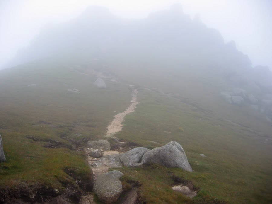
The climb to Suidhe Fhearghas
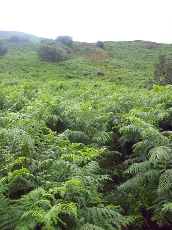
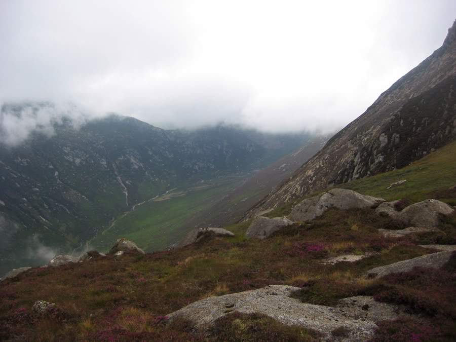
The initial plan was to begin at the second car park beyond Sannox and take the path leading from the car park up onto the Witches Step (which would be bypassed...) and then up onto Caisteal Abhail. Then I could go across, climb Cir Mhor and then head down Glen Sannox – hopefully without a rush to get back. In the end I did need to get back and Cir Mhor was cut from the plans. From the minute I arrived at the car park I realized that the initial ascent would be tough and the path - I came to find - weaved underneath bracken and I'd be shoulder-height in ferns. The slope was steep to start out with and I realized that I could have done with taking a slightly less demanding route. On the bright side I gained a lot of height quickly and trekking poles helped.
Of course, I won't learn* and I keep wearing jeans up hills - I headed up through high bracken, insects everywhere with hot and clammy air around my legs. Jeans didn't help one bit on this humid day. The upside to all this was that I ended up very high very quickly and I was glad to know the gradient would smooth off soon enough. I came over the top of the initial ascent, The Bastion came into view ahead across the glen and to my right was another steep slope, and the path wound right up it. I decided I'd give it a go as it was out of the plants and in slightly higher up, cooler air.
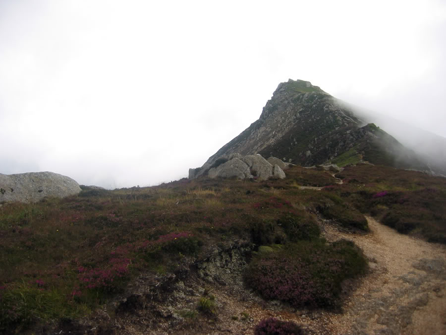
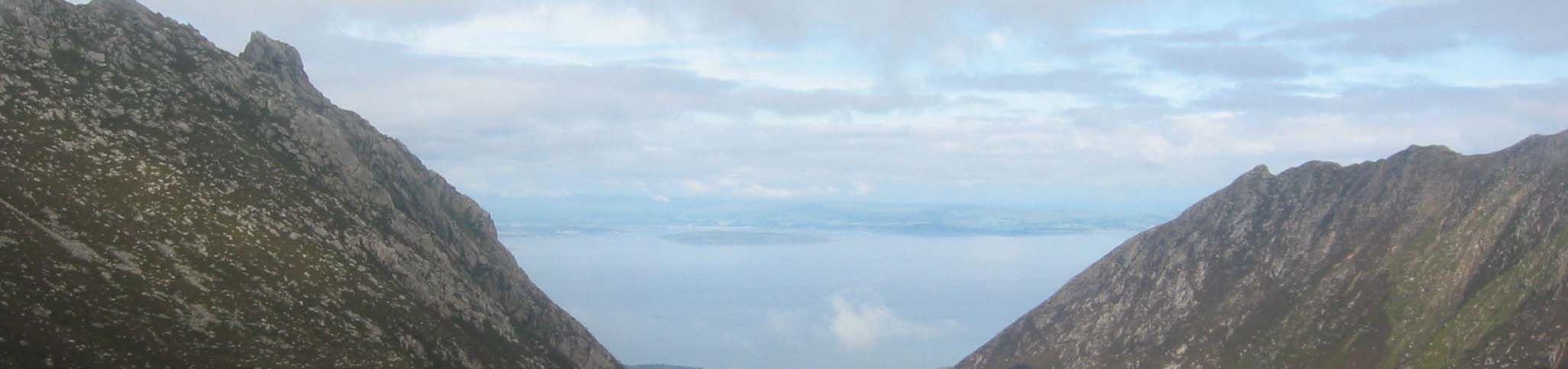
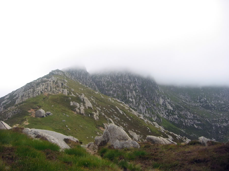
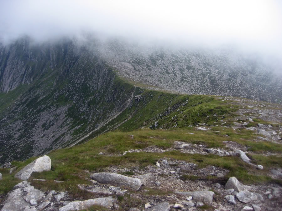
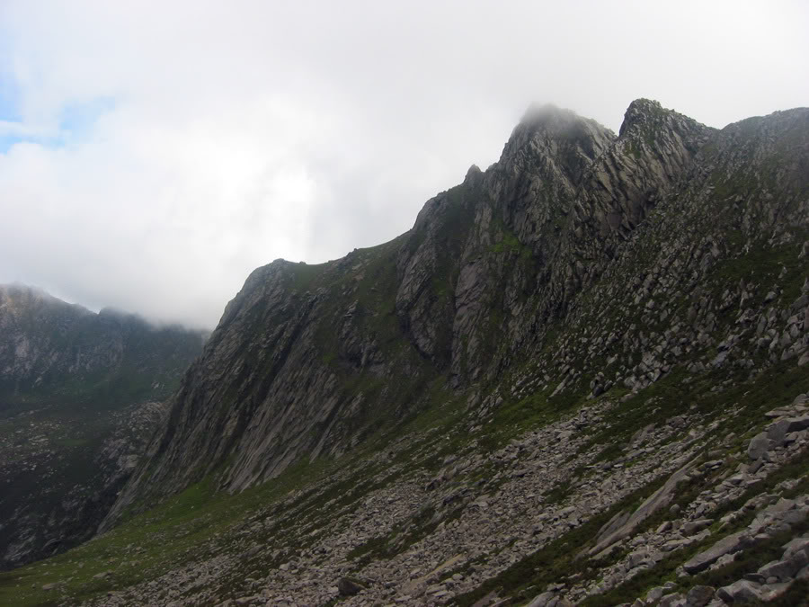
I ascended that slope too and the gradient finally eased off again. There was a sharp ridge ahead of me and it was one I'd seen from mountains around about. It looked impressive from elsewhere but getting to it wasn't nearly as fun as looking. Maybe I just picked a bad day but who knows? I walked through the cloud which every so often broke up giving distant views. It was the type which swirled and got caught up on other clouds or just sat suspended oddly a thousand feet above the valley opposite. Photographs will never do this type of odd cloud justice but even on an overcast day, it's quite a sight to watch. The walk to the top Suidhe Fhearghas ("Fergus Seat", apparently) gave me all sorts of cloudscapes and after I'd got onto the ridge, it was an easier walk along the top. It was a ridge with some nice exposure and drops but no technical bits. Before long I was on the top. Here I stopped again for some rest, food and drink as is usual although I left after five or so minutes. The Witches Step floated out of cloud ahead of me and it appeared abruptly. Now that I was on an even level with it, it didn't seem so daunting as it had previously but walking alone on ridges, high and steeply above the valleys wasn't a place to be testing my head for heights. I was bound for the northern side bypass path.

To the top of Caisteal Abhail
I left the ridge and ended up taking paths and then losing them across steep northern slopes, covered in granite boulders and with streams passing through. It was hard going, I'd lost a lot of height and knew it was going to have to be regained. Bypass doesn't always mean “easy-out” and I may as well have avoided just the Step rather than undercutting the entire ridge.
I was getting a bit tired and set my sights on Cuithe Mheadhonach – which is essentially Caisteal Abhails Northern Spur. Following many a sheep trail got me there and I spotted wild deer in the process in the valley a few hundred feet below. I enjoy seeing wildlife in these places.


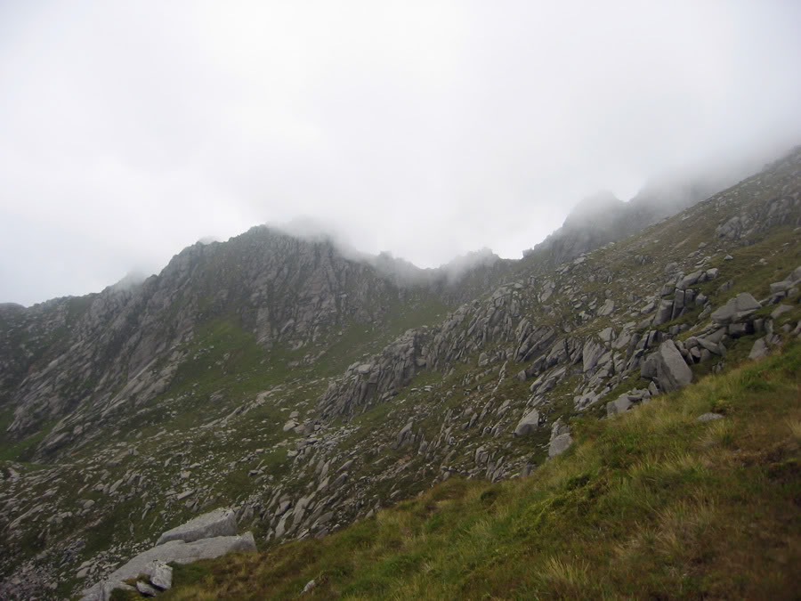
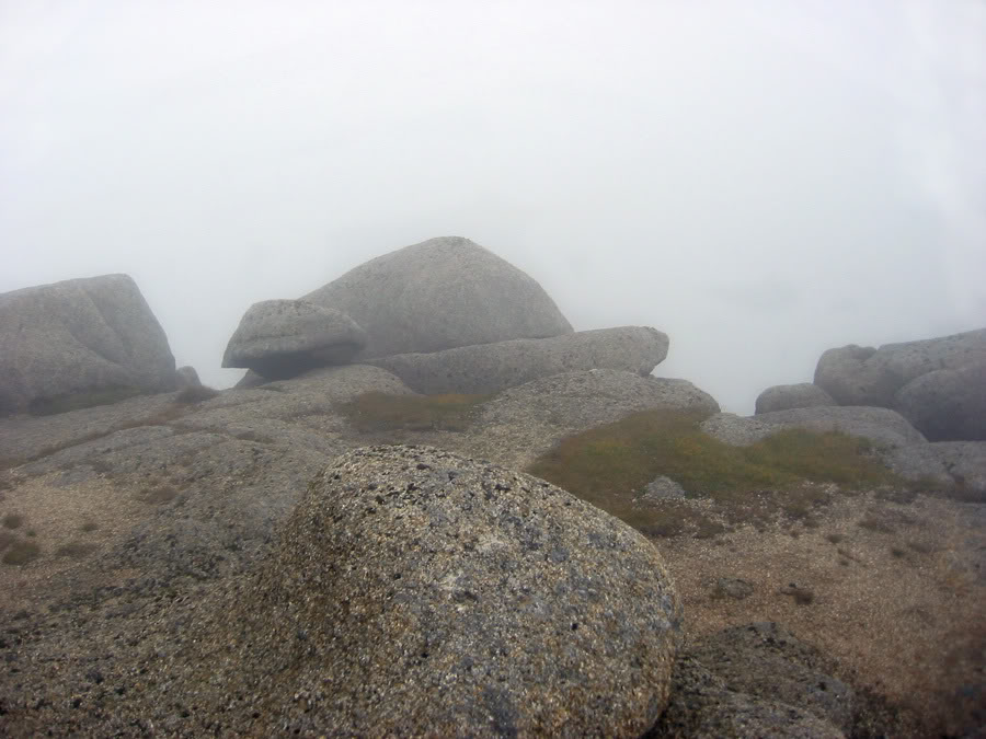
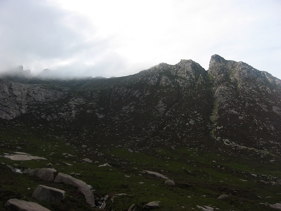
When I ended up on the ridge of Cuithe Mheadhonach, it was a long slog ahead and one which I just went for with barely a rest. I wanted up to that summit however hard going it was. I headed back into dense cloud but kept following a sketchy path upwards and arrived at some granite tors. A wind had also picked up and I was growing weary of the fact that I was alone on a craggy mountain I hadn't been to. Good friend the GPS was out of battery so out came the map and compass which is something I actually do fairly rarely.
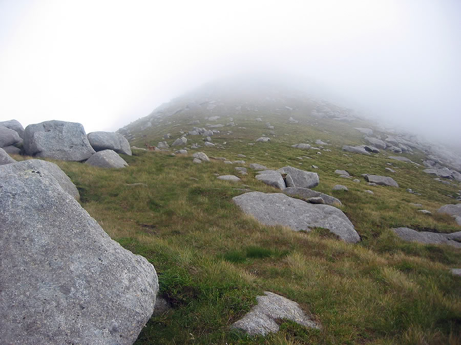
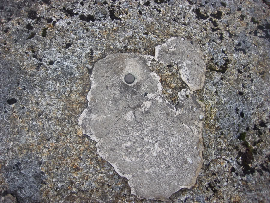
I knew where north was already – I'd come up from that side and although I could put the map the right way based on that, I wanted to the compass to comply which it initially didn't. Not sure why, but eventually I managed to get the map and compass working in tandem which confirmed the direction of ascent route. Or just generally made me feel better about where I was. That was some thick mist and I didn't want to be stumbling lost around summit tors. I climbed up onto the first tor I found and wasn't sure if this was the top but it seemed like it. Then again I couldn't see more than 10 metres to check if there was any higher ground. I went to the next tor to check it, but looking back I could just make out that the first one I was on was higher. So on I went back to the first one and on there for the second time I decided this was the top. There was some metal embedded into the rock as if there had been a one-time trig point or something – I can't be entirely sure about what it was.

Descent
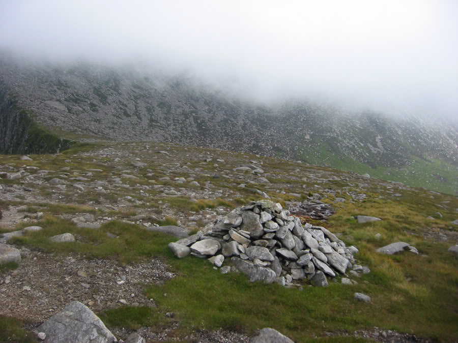
Well this was it ... true top or not this was my summit regardless. I wanted to head down as the wind and mist was just getting to me, and I wanted to see things again. I took the south-east shoulder of Abhail down through the mist. The map and compass told me I was going in the perfectly right way but I couldn't be sure – I just felt as if I wasn't able to trust it enough. To keep myself reassured, I created the rule called “trust the map and compass”. It worked – I arrived at a cairn just as the cloud cleared and suddenly all was revealed. It was at the cairned springs I was at. Spirits went up and I allowed myself to become a little more off my guard. Thinking back, I'm not sure why I was so edgy about low visibility. Before then and since I've walked around confidently enough without being able to see a damn thing, but on Caisteal Abhail I was very uncomfortable with the cloud. Who knows though.
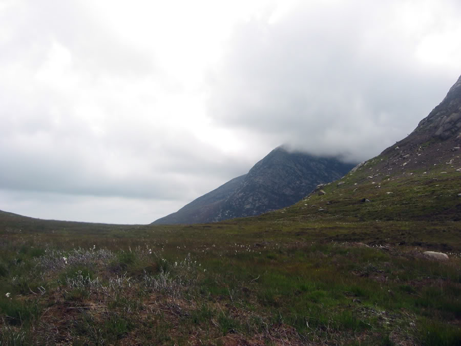
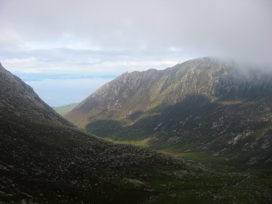
I walked down to the Cir Mhor/Abhail bealach and headed straight down into the coire. No visit to Cir Mhor today. The initial descent was steep over loose rocks, although some of it could be slid down. That brought me to easier ground as the gradient flattened out yet flatter ground created bog at the same time.
Note, 10th April 2017: I never wrote it at the time, but I had the worst of 'number 2' incidents near the head of Glen Sannox. Through the day my psyche and composure had been down the plughole, and I attribute this to 'holding it in' (enough said) - then I got caught sans loo roll... oh dear. Again, enough said. But it did negatively affect my psyche immensely and is something worth paying attention to in general.
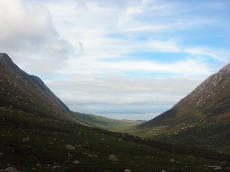
After passing the avoidable bogs, the descent from Coire na h-Uaimh to Glen Sannox was awkward. It was all very overgrown, there was absolutely no sign of a path and descending steep ground was hard. Lower down, heather covered streams created more problems and occasionally I'd step down and plunge into a hole beneath. It was very hard ground to walk through - not recommended at all and it came as a relief to me when I picked up the well-built track through Glen Sannox. I also observed that for being a footpath on the map, the ground from The Saddle to Glen Sannox was very, very steep and rough. Most definitely not a path.
However, I shot down Glen Sannox, intent of getting back. About an hour after I picked up the track - at quarter to six and 15 minutes before I was meant to meet mum and dad in Sannox, they showed up part way up the track so that was a nice end to the day. The sun was out and I was feeling well, even if a little exhausted from the days exertions. But damn I stunk afterwards. Showers never felt so good... :)

Times (Time relative to 0.00)
(0.00) 1.05pm Sannox car park
(1.10) 2.15pm Suidhe Fhearghas
(2.40) 3.45pm Caisteal Abhail
(4.50) 5.55pm Sannox
(0.00) 1.05pm Sannox car park
(1.10) 2.15pm Suidhe Fhearghas
(2.40) 3.45pm Caisteal Abhail
(4.50) 5.55pm Sannox
Written: 2008-07-22, 2008-08-11
Edited & added new photographs: 2010-01-20
Edited & added new photographs: 2010-01-20