Beinn a' Chlaidheimh - 916m
Sgurr Ban - 989m
Mullach Coire Mhic Fhearchair - 1019m
Meall Garbh - 851m
Beinn Tarsuinn - 937m
A' Mhaighdean - 967m
Ruadh Stac Mor - 918m
Monday 10th & Tuesday 11th August 2009
Sgurr Ban - 989m
Mullach Coire Mhic Fhearchair - 1019m
Meall Garbh - 851m
Beinn Tarsuinn - 937m
A' Mhaighdean - 967m
Ruadh Stac Mor - 918m
Monday 10th & Tuesday 11th August 2009
 Weather/Conditions: Sun and shifting cloud on the morning of the 10th. Mist, rain and wind at the summit but with breaks revealing sun-dappled mountains elsewhere. Beautiful sunset, followed by a cold bivouac and subsequent overcast day. A weather front that we were expecting arrived as we left Shenavall bothy bound for the van, and for the remainder of the trip were battered by heavy rain and high winds.
Distance/Ascent/Time: 48.4km / 3300m / 33h 25m
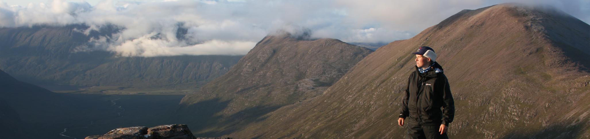
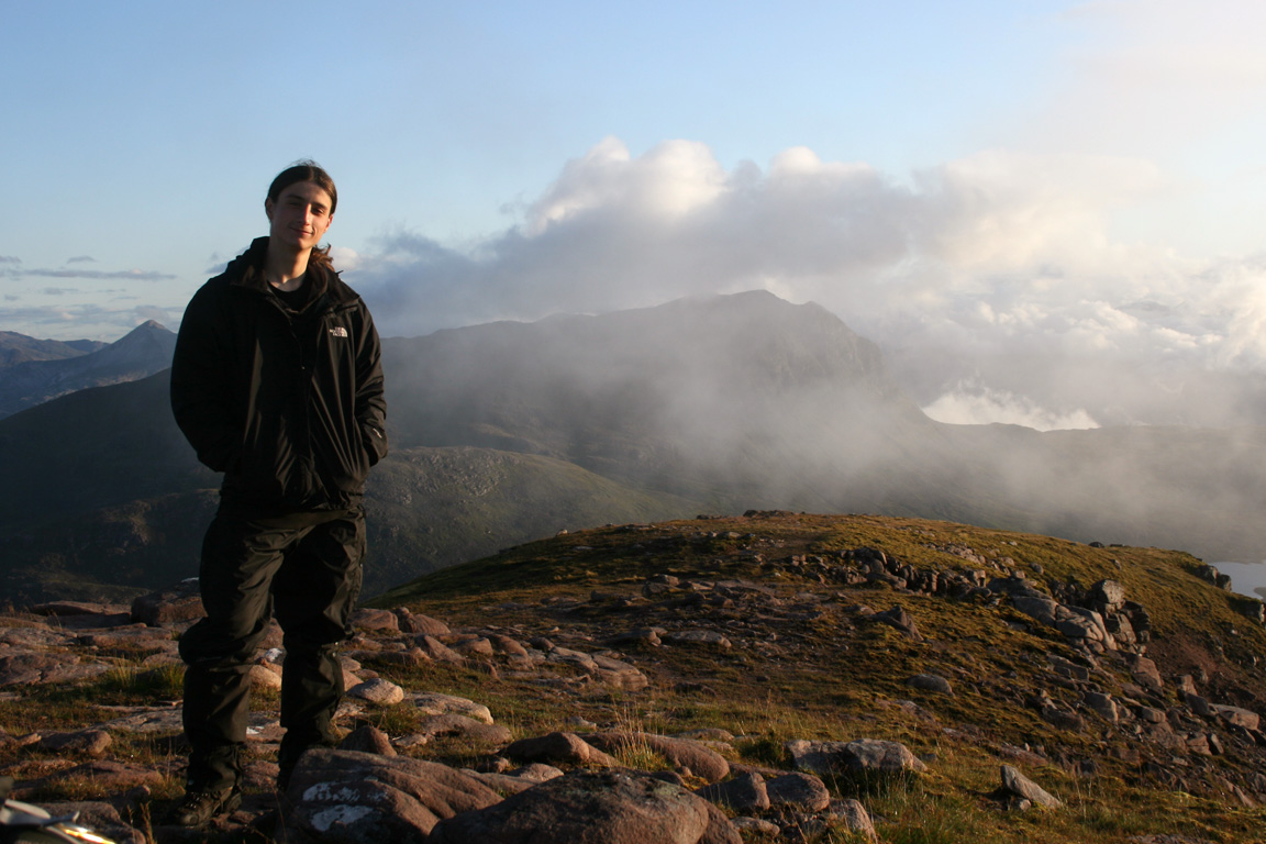
Accompanying: Michael Coffield
The previous day, we'd climbed Conival and Ben More Assynt in the morning, followed by driving to Ullapool and climbing Stac Pollaidh in the evening. In Ullapool, we booked into the Ceilidh Place Hotel before deciding to climb the Fisherfield Munros over the next two days. Having been slowed down by hours of walking over the past couple of days on very little sleep, it wouldn't be a route we were going to complete quickly. We'd have two days and that was ample time.
The next morning, I awoke at 6am. The room was very comfortable (especially after a couple of rough nights under a tent), but I was up and about and met Michael. We were on our way fairly soon and stopped by the garage in Ullapool for the trips supplies before driving on towards Dundonnell.
At Dundonnell, we packed our gear, which took a considerable amount of time. This included making sure all our walking gear was with us (we'd thrown it into the back of the van to escape the Stac Pollaidh midges) as well as bringing camping gear - sleeping bag, mat and tent.
Dundonnell to Beinn a' Chlaidheimh, via. Shenavall
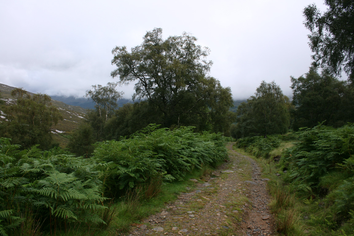
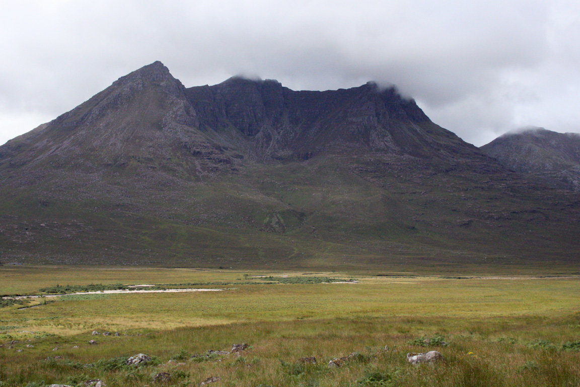
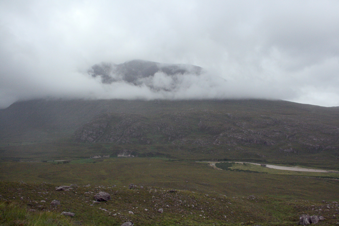
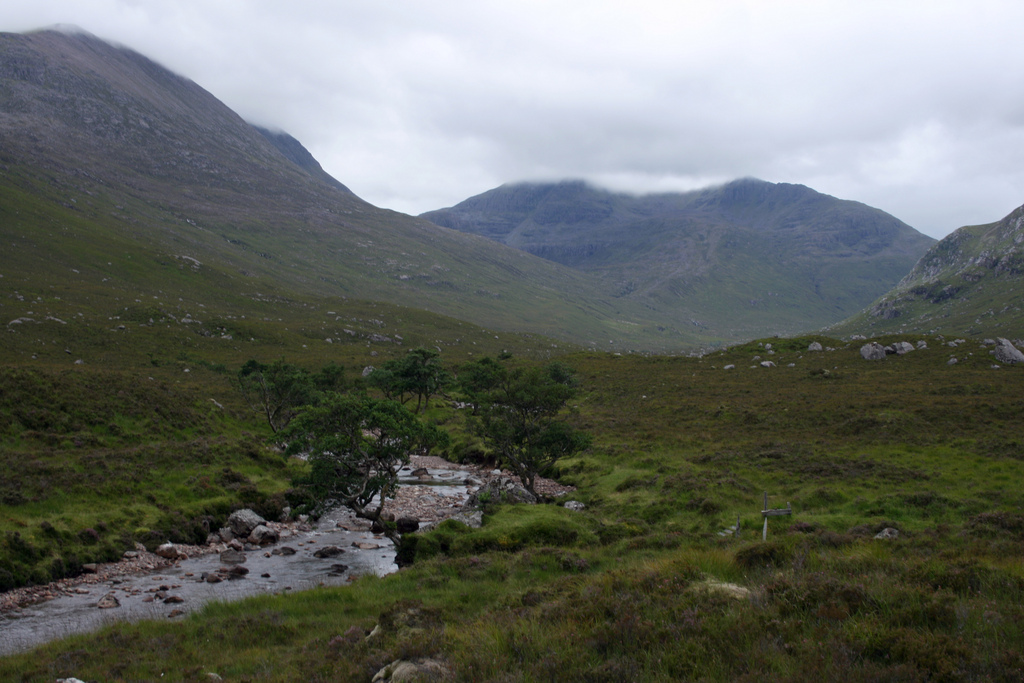
We got going at 8.55am, following a rough track upwards into the valley. To get to Beinn a' Chlaidheimh, we'd have to climb out of Glenn Chaorachain, go over the top of the moorland, descend 300m to Shenavall, then commence climbing Chlaidheimh essentially from sea level. The track from the Dundonnell lay-by followed a gentle gradient upwards, which offered a pleasant walk alongside Allt Gleann Chaorachain. An Teallach was above, but we would only see glimpses of it's spectacular ridges along the way.
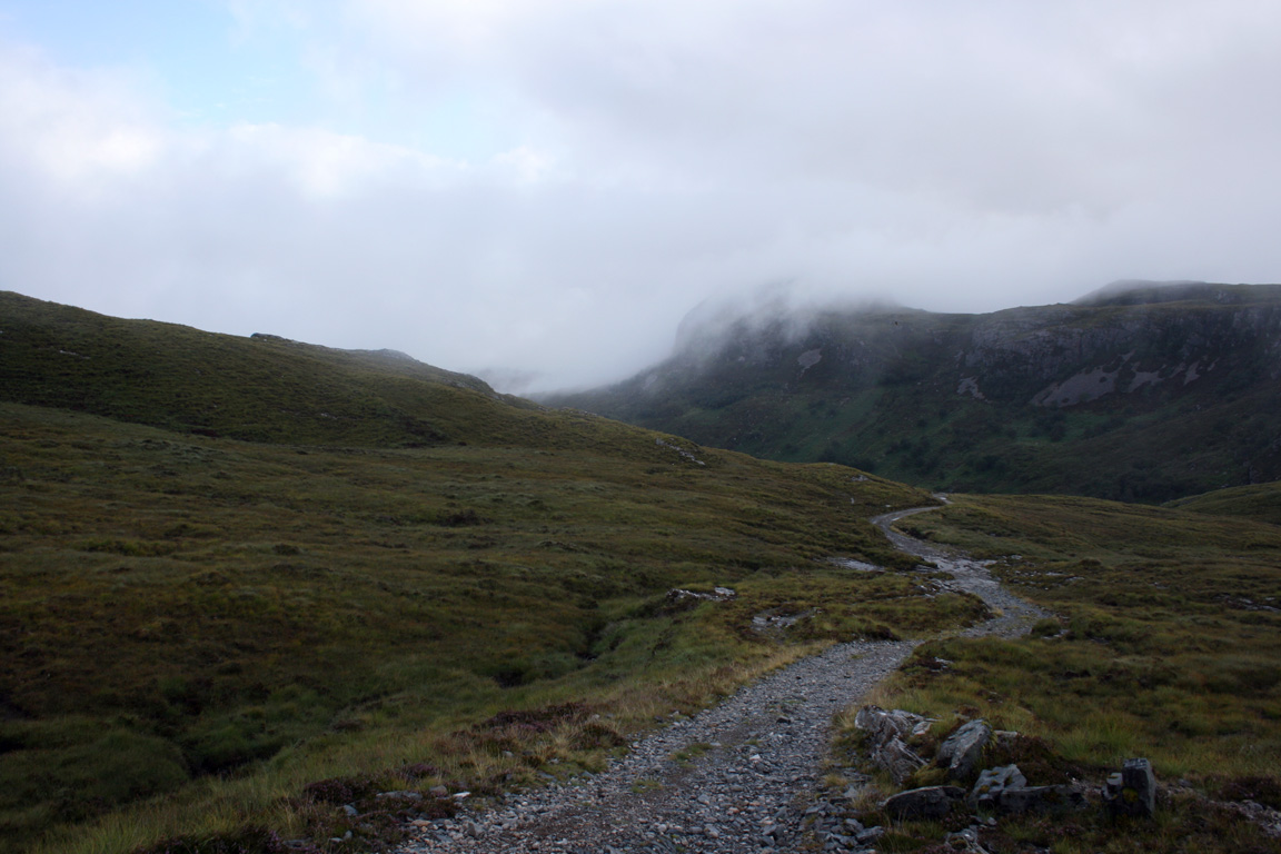
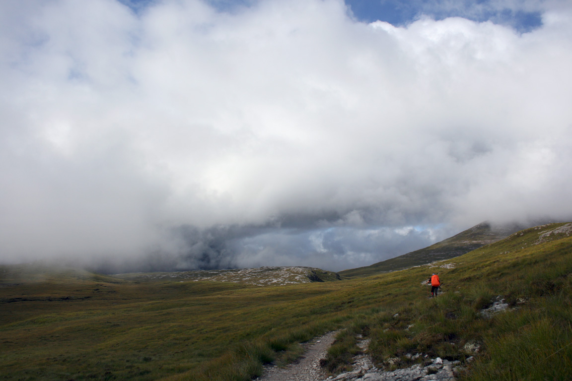
We emerged onto the high moorland, where a cairn marked the high point of the track. The sun was coming out too, but the Fisherfield peaks were still caught underneath heavy cloud. At the cairn on the moorland, we turned off the track and followed a rough path beneath Sail Liath, beginning the descent to Shenavall. The path then funnelled into a small enclosed valley before emerging out at Shenavall below.


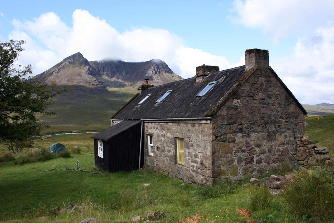
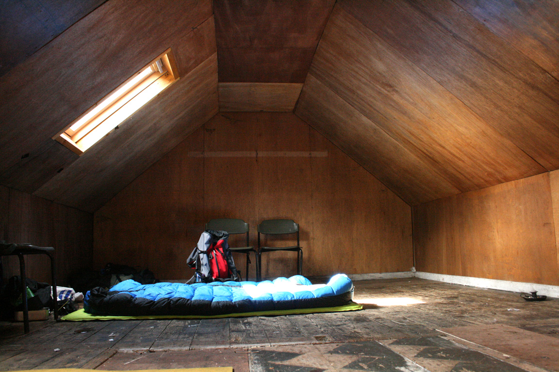
We took some time to look around Shenavall and left our camping gear in the hallway. Others had reserved just about every other room, so the hallway was next best to camping outside. It was nice to finally see Shenavall having heard about it for a long time, even if some of the comments were more along the lines of 'shithole'. In it's present form, I wouldn't have expected much different from a bothy. With our camping gear dropped off, we headed on our way to Beinn a' Chlaidheimh with the intention of getting back before the day was out. I knew our route was long but reckoned that we could get back even if it was the middle of the night.
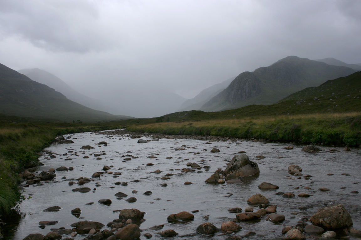
A path took us to the river - known as Abhainn Strath na Sealga - which is well known for being uncrossable at times. Given that there's no bridge, the best option seems to be to pull the boots off and wade across barefoot or with sandals. The water level was very low today, so we could get across by jumping from rock to rock. This is apparently a rarity but even with the low volumes of water it wasn't an easy crossing and trekking poles undoubtedly came to good use.
Once on the other side of the river, we headed towards Beinn a' Chlaidheimh in the direction of a ramp running up between the cliffs. Below, the terrain was tussocky and quite boggy. Higher up, a mixture of grass and boulders. The northern slopes were steep, because we didn't want to go all the way eastwards as far as to get out of the way of the crags.
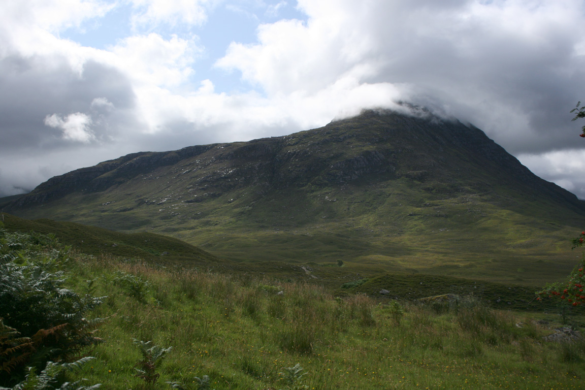
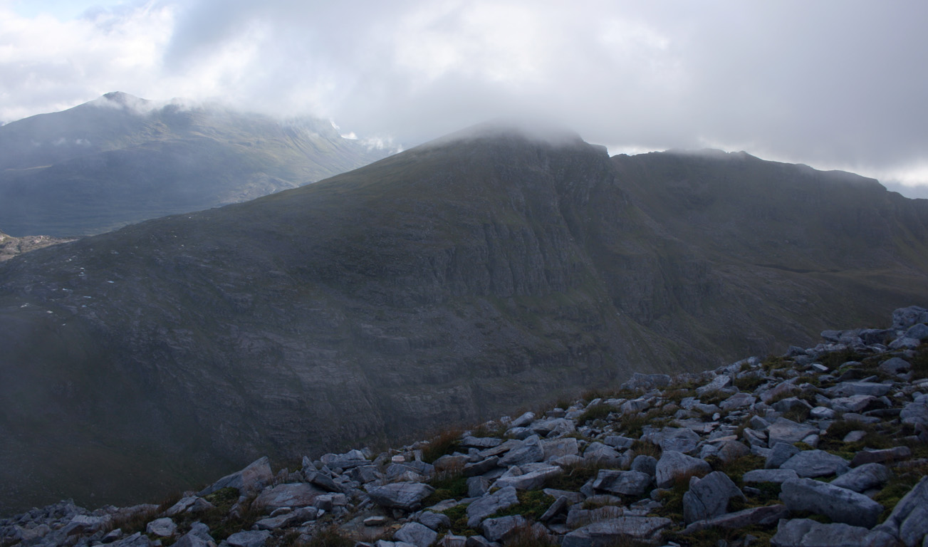
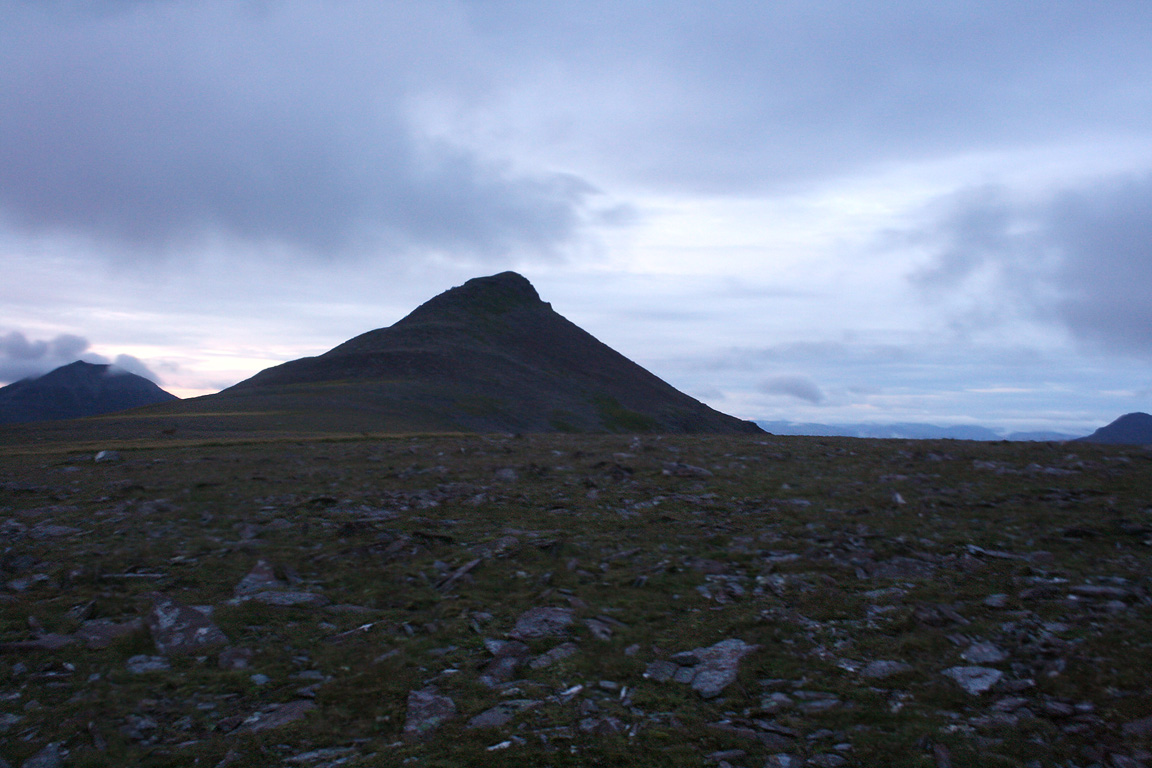
We then arrived over the top of the steep slopes and onto the more gentle eastern slopes. From there we were in cloud and continued to be so all the way up to the top. After another brief steep climb, we found the north ridge, and followed it over the north top all the way to the summit where we arrived at 3.15pm, a long 6 hours 20 minutes after we started out. The previous days must have really taken their toll...
Sgurr Ban
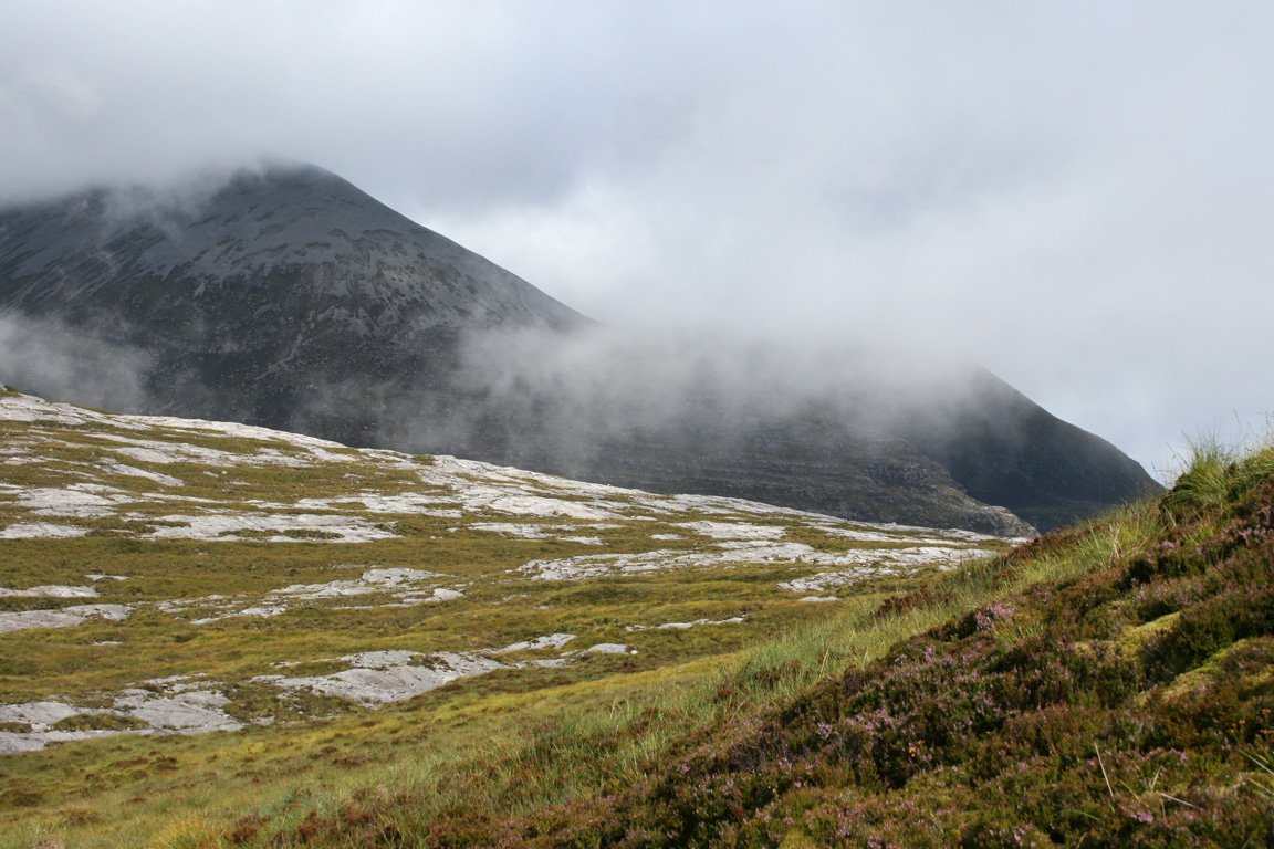
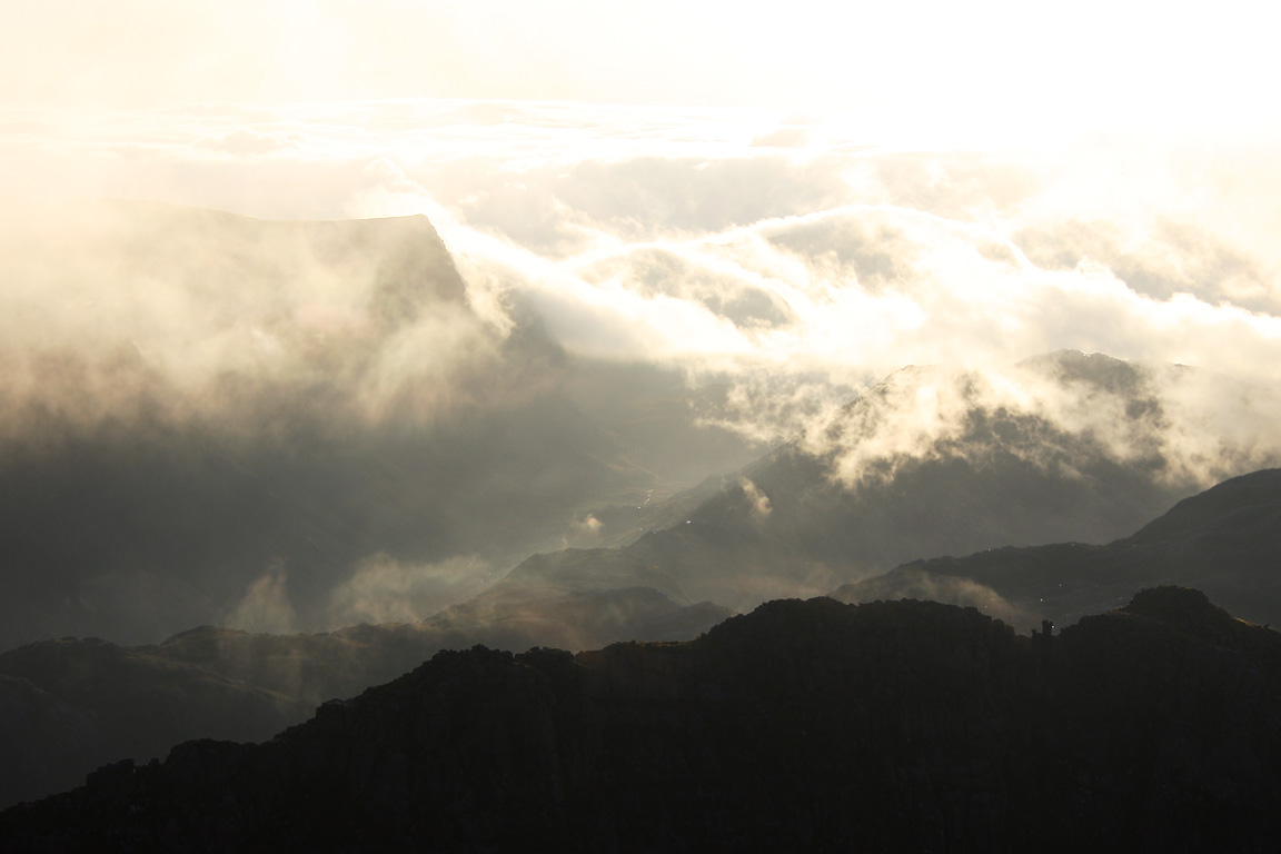
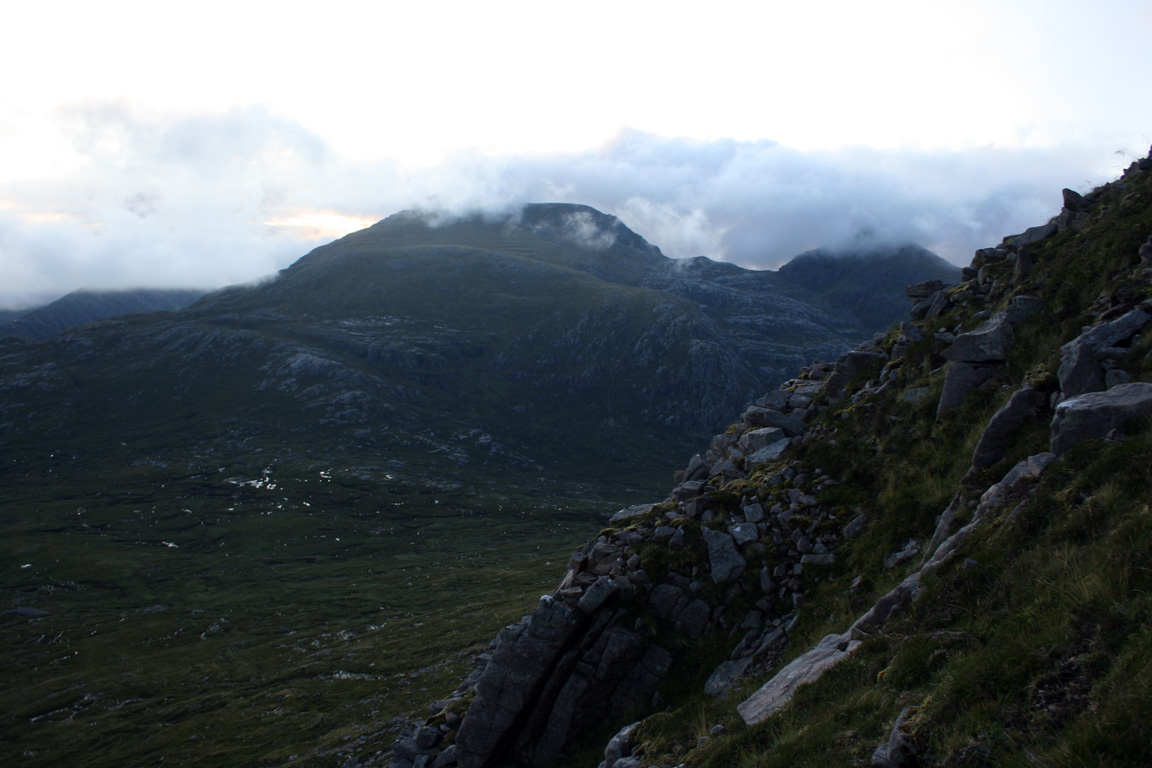
There wasn't anything to see on top of Beinn a' Chlaidheimh so we continued south towards Sgurr Ban. We skirted past the south top and then down to the bealach below where we met two people - the only people we'd see for many hours. We also found that now out of the cloud, most surrounding mountains were in the sunlight with cloud dappled around about. The views while they were there were actually quite beautiful.
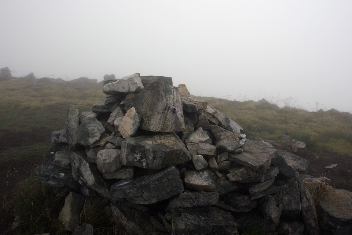
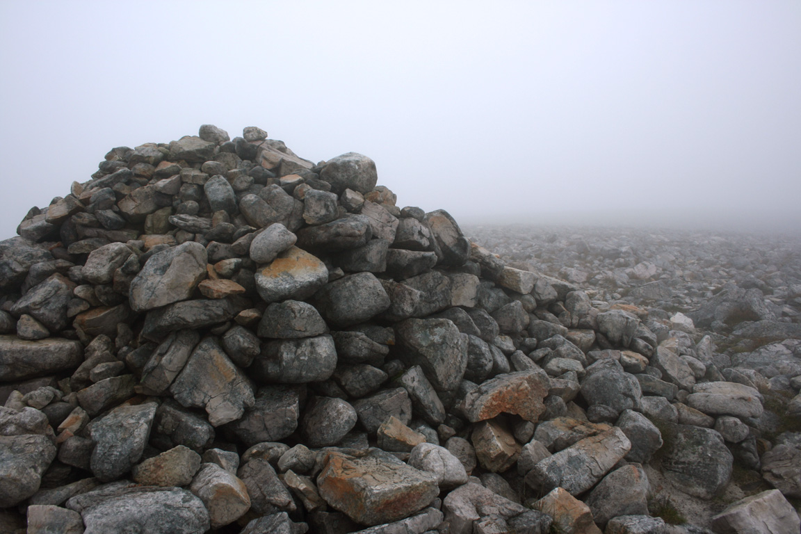
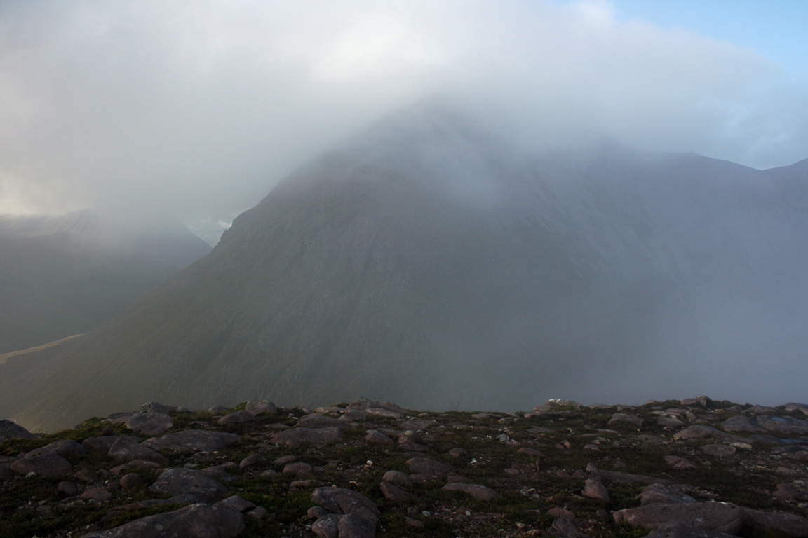
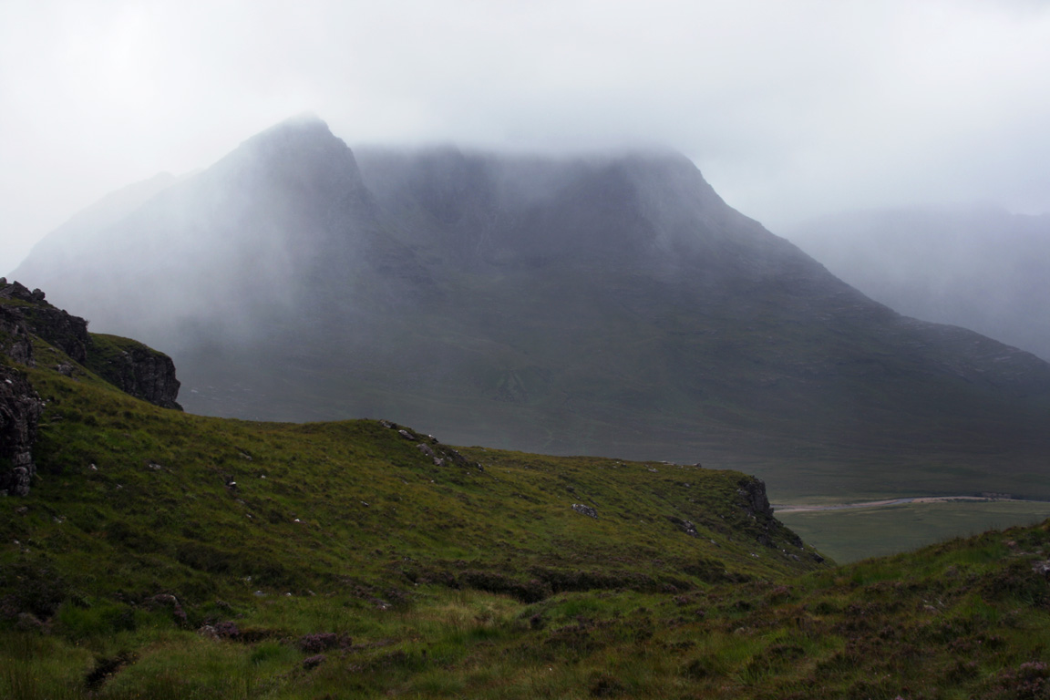
To get to Sgurr Ban, it was a long ascent up boulder fields that would take us all the way to the summit. We ascended into cloud once more, and followed the white stones (hence the name 'light peak') up to a small summit plateau where there we came upon a cairn. Just another cairn in the mist, I suppose! I felt it was a bit of a shame to see these peaks in the mist, because I presume the views must be quite spectacular, especially towards An Teallach to the north. But there would be plenty more walking yet, plenty more opportunities to see the landscape.
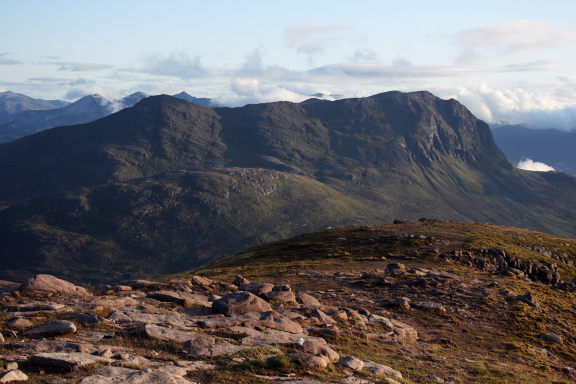
Mullach Coire Mhic Fhearchair and Meall Garbh
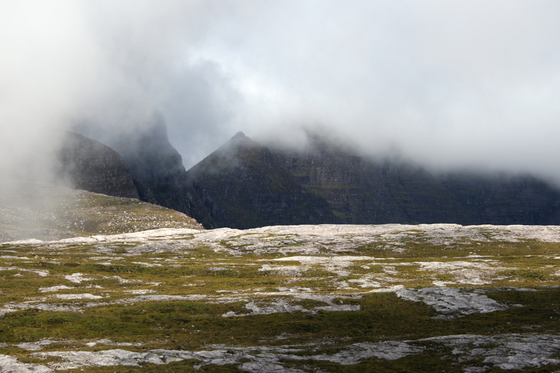
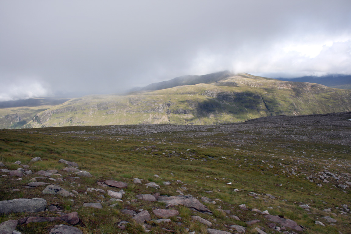
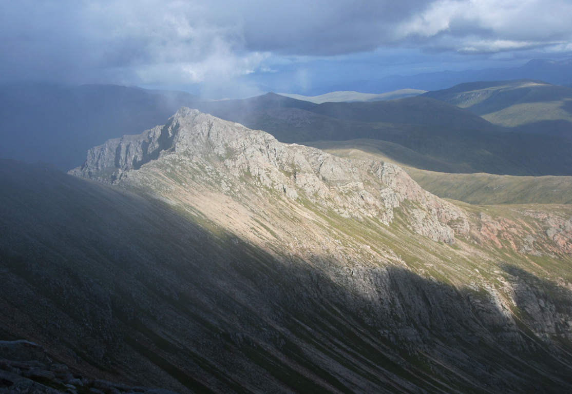
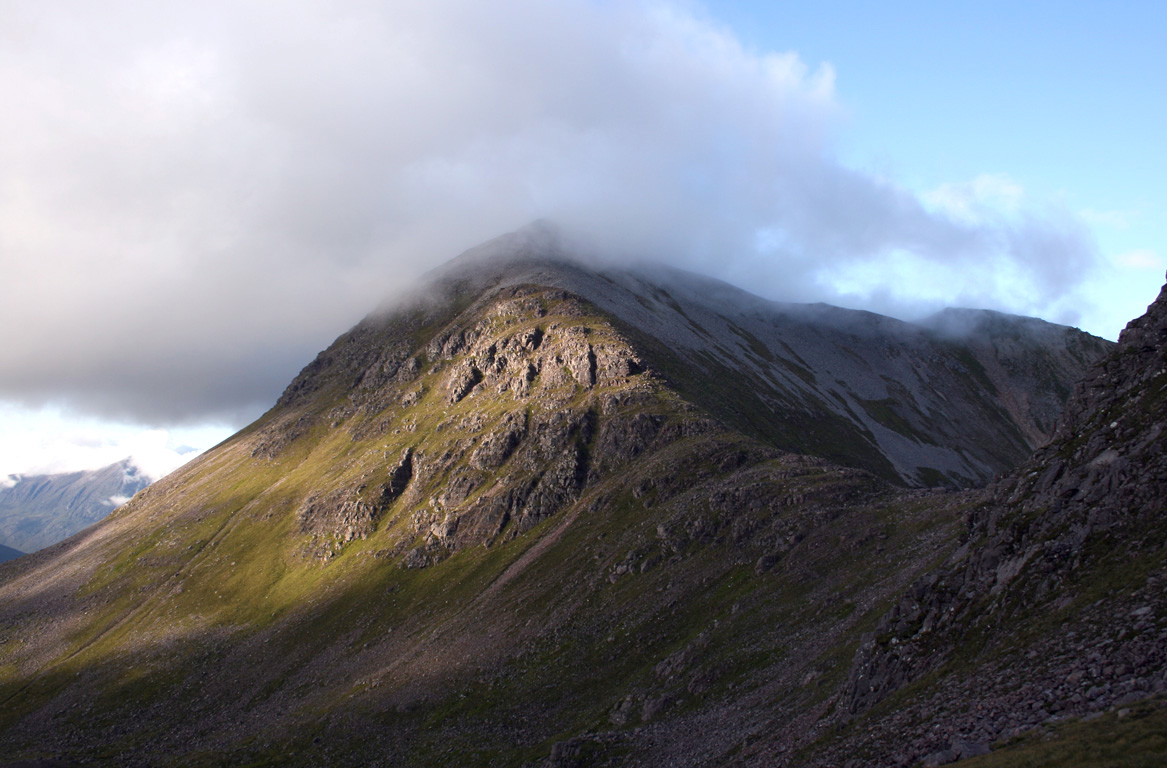
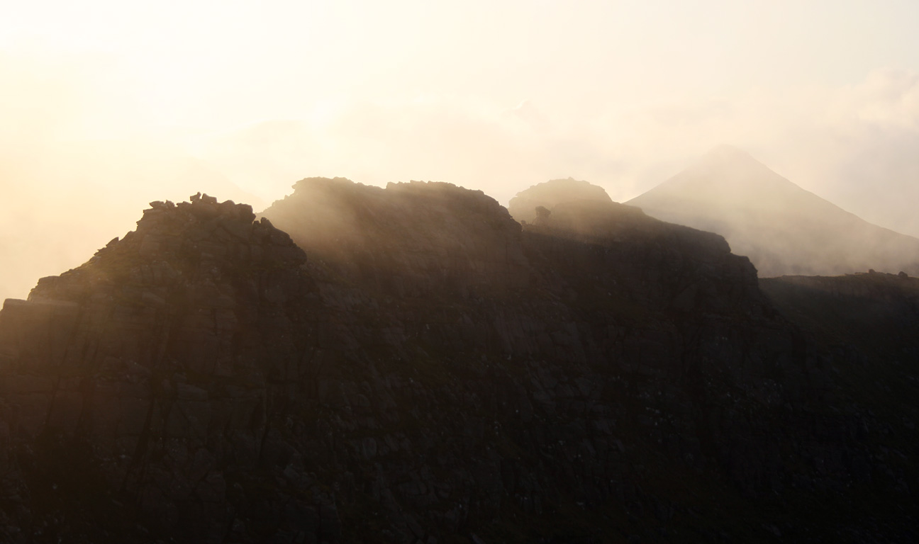
Next was the highest hill of the Fisherfield Six, and one which I turned out to have some fondness of. It isn't a large hill - 1019m high - but has the appearance of being much higher. It is also fairly steep sided so would give an entertaining ascent. A small path brought us down Sgurr ban to the bealach, where we arrived still in cloud. But as we climbed Mullach, the thick clag was beginning to dissipate and we climbed in an odd light, half way between cloud and sun. In the mist, with diffused shadows.

The initial slopes were very steep and loose, enough for Michael and I to both dislodge some of the hillside as we went. The gradient eased off a little higher up, and we followed the steep boulder field upwards. The whole place felt slightly out-of-this-world, and I owed this to the way the sun interacted with the clouds, casting a blue tint and muted shadows across the white boulders.

We arrived at the top 6.15pm, and we were both aware that in a few hours, the day would be drawing to a close. But it didn't bother us and we kept on going as planned. After a couple of minutes at the top, we descended the other side, following a beautiful ridge downwards. We'd descended a long way before I realised my trekking poles were missing. Michael realised that they'd been gone for a while, and my last recollection was having them on the summit. Michael continued to descend while I slogged the several hundred feet back up to Mullach's summit. If there was any plus side, I got to ascend by a few nice ridge, and I arrived at the summit for the second time, where a pair of trekking poles were lying on the ground. Back down I went.
On the way, I became disorientated and began to wonder if I'd gone the way I came up. It was a problem for five minutes, but I emerged from the cloud, got my bearings, saw Michael below and was very relieved to know I hadn't walked off the wrong side of the hill. I could have saved myself a lot of trouble if I hadn't left the trekking poles behind...

Once we'd descended Mullach Coire Mhic Fhearchair, Beinn Tarsuinn was next on order. First of all though, we were presented with Meall Garbh, a notch in the ridge that comes in as a Corbett Top. I generally enjoy climbing what tops I can, so I climbed to the top and descended again, while Michael skirted around it on the bypass path. We both met on the other side and took a couple of minutes rest before beginning to the walk to Beinn Tarsuinn's summit.


Beinn Tarsuinn
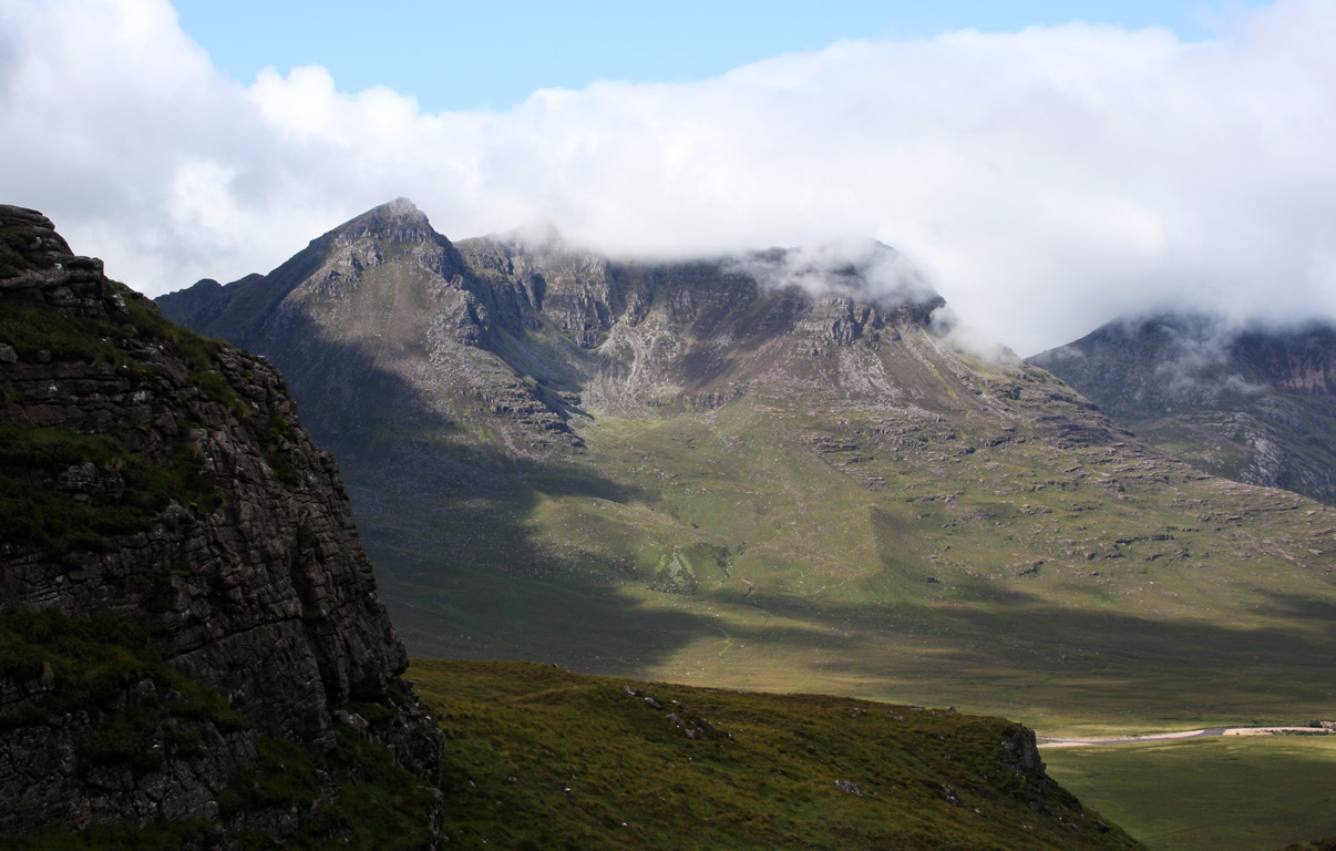
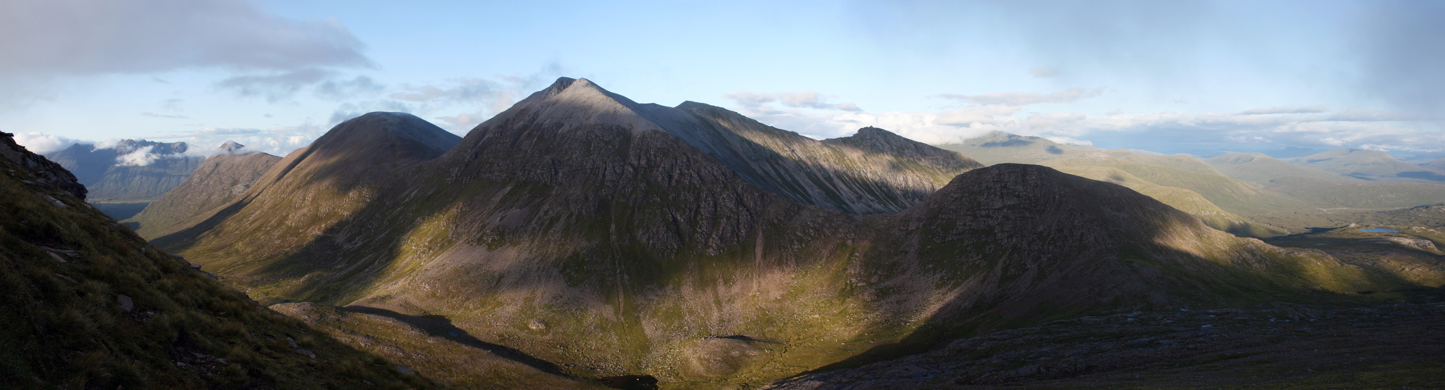
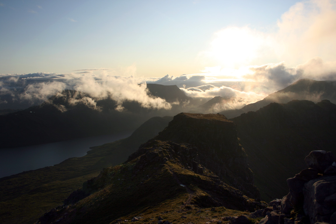
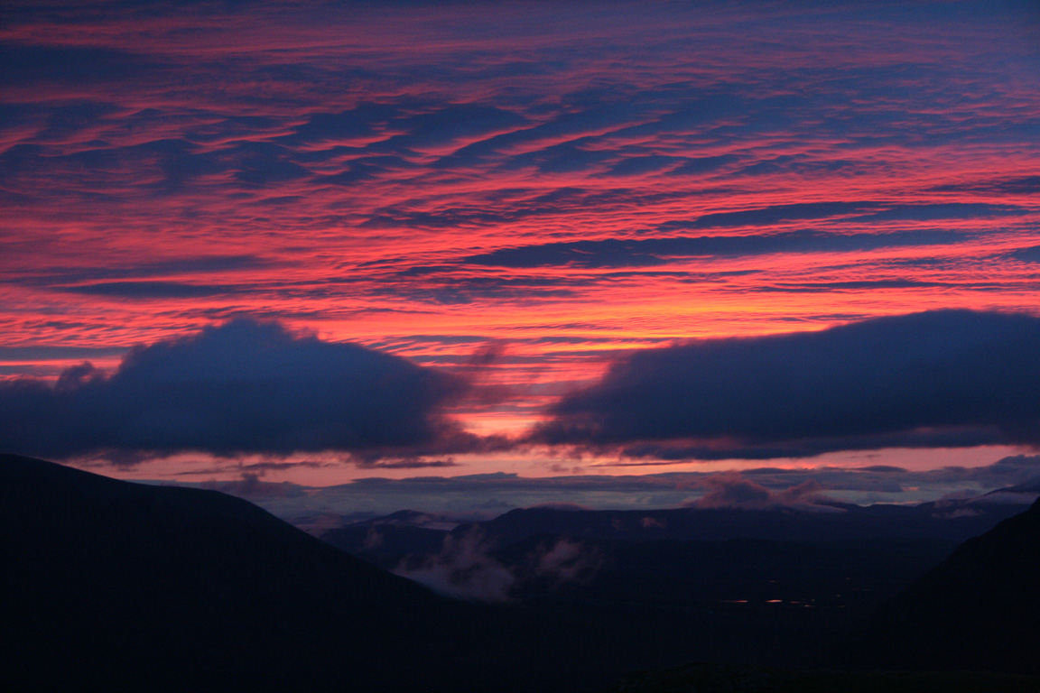
Beinn Tarsuinn was easily the most photogenic summit of the trip. It was from it's summit that we saw the sun set across the western hills, and it produced some spectacular results. The terrain leading up to the summit was all easy walking, but the views were breathtaking. We could see the three Munros we'd climbed over and An Teallach to the north, wrapped in mists. Slioch was to the south, and a vast untracked land lay to the east. Beinn Lair's northern cliffs were beautiful - they dropped two thousand feet to the lochs below and formed one great wall, unbroken for several kilometres. Vistas in every direction were mind-blowing, absolutely spectacular. It was such a place to be and I couldn't be happier.


It fascinated me that I'd found myself on one of the most remote Munros at sunset, and couldn't see a single road or building. Nightfall was approaching and we had only bivvy bags for shelter but I felt absolutely confident. We were happy to navigate over the next two mountains in darkness and although I'd considered descending into Glenn na Muice for the night, Michael was confident that the best way was over the tops. I didn't complain either, because walking by night is an experience in itself.
Though caught up among some of the most beautiful of scenery, I gave some thought as to how I found myself here, in a position that I would have scarcely dreamt of being in as little as two years ago. I had a definite feeling that I'd made a lot of progress.

A' Mhaighdean (in the dark)
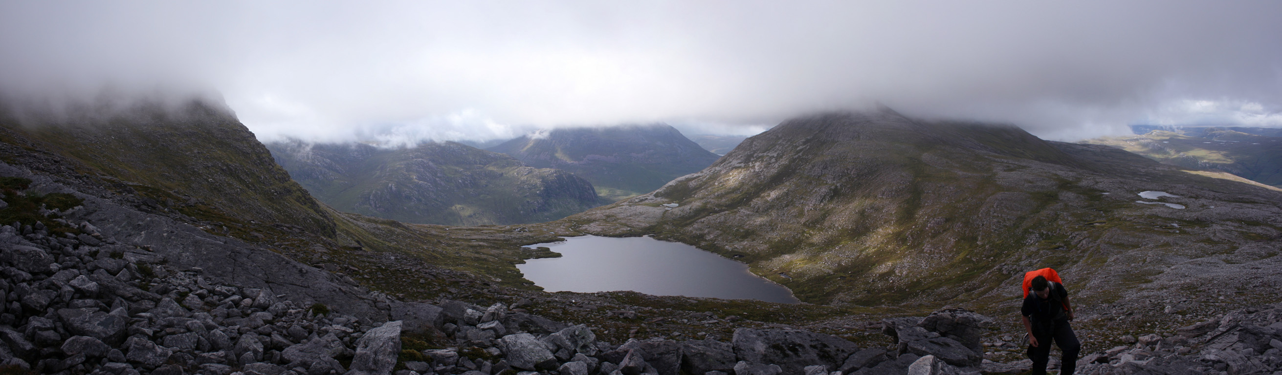
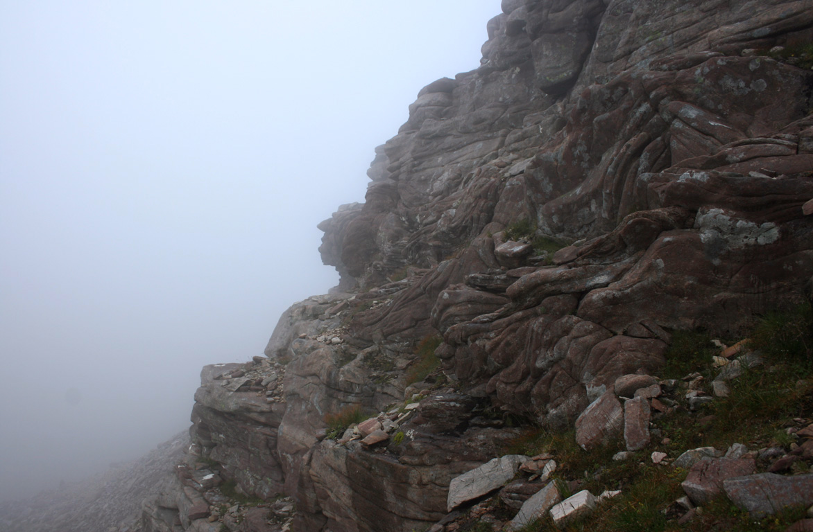
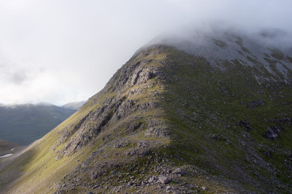
But even with the beauty of the sunset, we were aware that we'd have to get going and cover as much ground as possible before nightfall. We spent perhaps ten minutes on top of Beinn Tarsuinn, but continued onto A' Mhaighdean via. it's spectacular west ridge. There is some scrambling involved in negotiating the knobbly ridge, and we descended to a table like feature of flat bedrock suspended in the air. As the first obstacle on the ridge, we couldn't help but climb onto it's flat top and marvel for a moment at such geology.
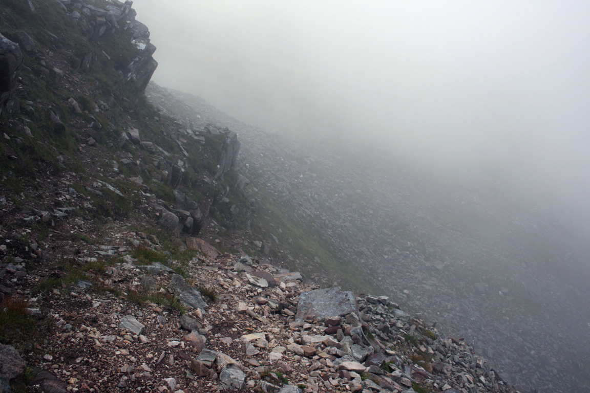
After some moments of very enjoyable scrambling (and steep drops) we left off the crest of the ridge and walked along the bypass path to gain as much time as possible. We then descended the slopes of Beinn Tarsuinn when the gradient eased off and headed in the direction of A' Mhaighdean. The bealach connecting the two mountains is only just above 500m, so there would be a considerable amount of reascent on the other side. The bealach below was a broad and obviously a boggy place, although largely dried out during our passing.

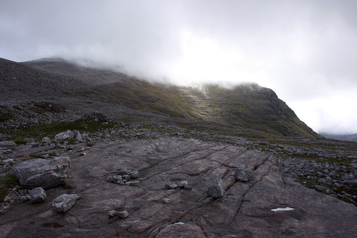
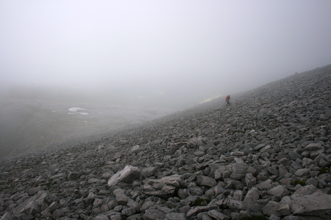
It was here that the light also began to fade and we climbed the slopes of A' Mhaighdean in increasing darkness. The ascent to the summit involved climbing many vertical metres, although I don't remember it to be much of a slog as we climbed into the darkness. Once we'd gained some height, we found the southwest-facing cliffs and knew that we could follow them all the way to the summit.
I had two torches on me, although both were relatively dim. Michael had a brighter head torch (much more suitable for the circumstances...) and as I walked in front, able to vaguely see the ground in front, Michael stopped me and shone his torch on the ground a couple metre or two in front of me revealing a cleft in the cliffs reaching inwards, crossing my potential path. I didn't see it then and probably would have continued not to see it, but a fall down that little gap would have left me a lot more metres lower down from where I fell. Caution was to be called for, mistakes could easily be made and if we were going to follow the cliff line, I was going to make damn sure I knew I wasn't going to step into thin air.
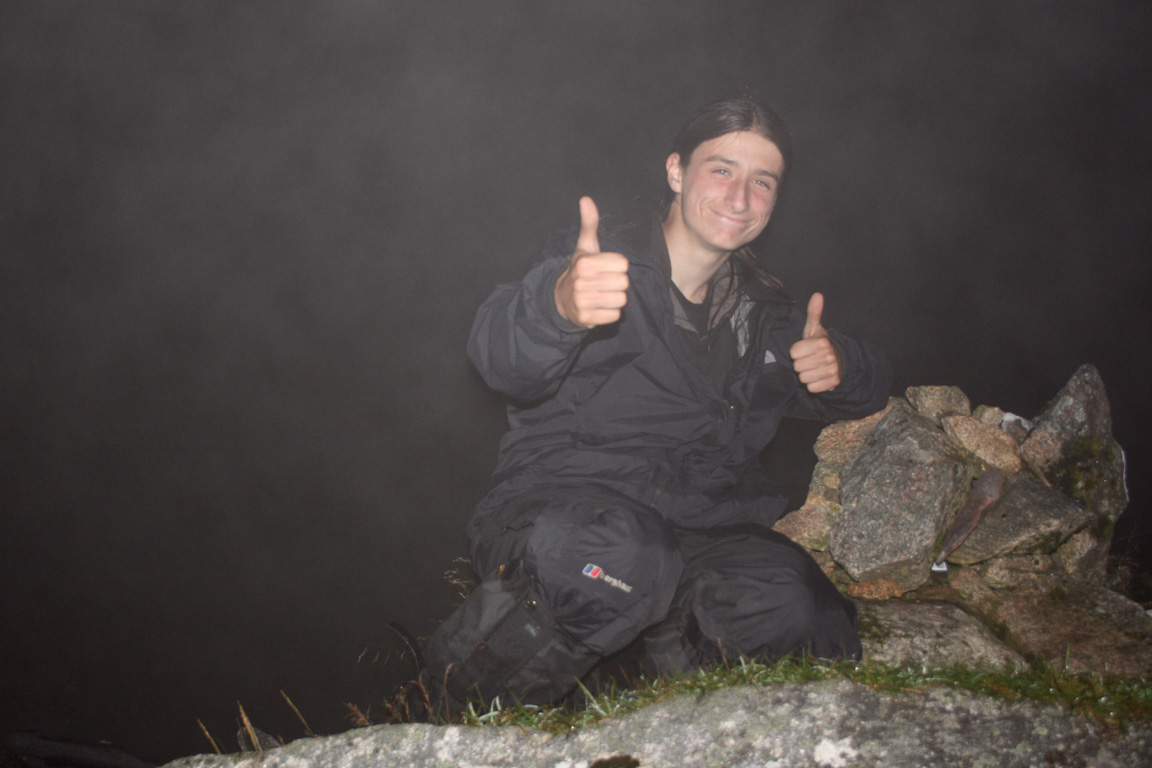
We'd ascended into the cloud by this time, and could only make out vague shapes through the dark. Still, walking with the cliff-edge in sight turned out to work and we arrived on the summit of A' Mhaighdean at 10.40pm. It was marked by a small cairn and cliffs fell immediately away to the west. We spent about five or ten minutes on top, taking pictures (flash necessary) and being glad to be up here. Furthermore, A' Mhaighdean is Scotland's most remote Munro, and to climb it in the dark was special.
Descent from A' Mhaighdean and Bivouac
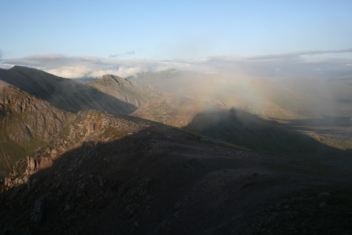
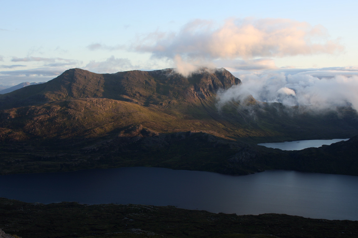
The next thing we had to do was to descend from A' Mhaighdean towards Ruadh Stac Mor. We left the summit cairn, heading on a path towards the north subsidiary top. This path vanished, but we walked around the east side of the summit dome then came to a large cairn that sat on top. We took a quick break here, firstly to check navigation, but secondly because the cloud had just cleared. The moon was also out and offered us some light in an otherwise dark landscape. The views were quite striking and illuminated were not only the mountains but bands of cloud around about us. Sadly, I couldn't take any photographs (although I attempted to) but the memories remain. I suddenly had an impression that we were being granted a glimpse into another world, standing from our viewpoint high on a plateau with moonlit and clouds mountains around about. Mullach Coire Mhic Fhearchair and Beinn Tarsuinn were silhouetted given that the moon was high about the south eastern horizon, and although I could sit and watch the views all night, we had to move on. I was tired now too, and rolling out the bivvy bags and lying on the mountain top seemed like a nice idea. We'd been walking for over 14 hours, so a rest seemed like a nice idea.
But with these views still present, we began to scour the summit plateau for signs of a path on. We'd began walking back in the direction of the main summit when a path led down the eastern slopes. It was often difficult to keep on track with a path, but the presence of one in the first place was of great help. Then at 770m, we lost it. We arrived at a point where we had the option of a couple of gullies to follow and the path seemed to go neither way. We scoured for footprints or signs of a way to no avail. At one point we found my footprints having walked in circles. So we had to make a decision as to which way to walk. In hindsight, going right would have been the best option to allow us to arrive underneath Ruadh Stac Mor, but without hindsight, we went left, and followed a gully downwards.
The gully became fairly steep at points and we'd occasionally be on all fours, down climbing small sections to get to easier terrain below. By this point, the clouds had come in thicker and we couldn't see Ruadh Stac Mor. We hadn't seen if once, but if we had, I'm sure our situation would have been a lot easier.
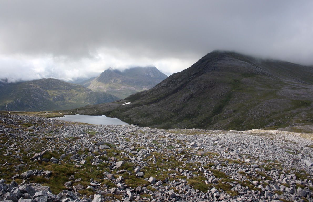
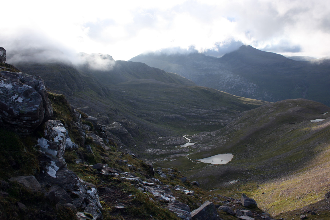
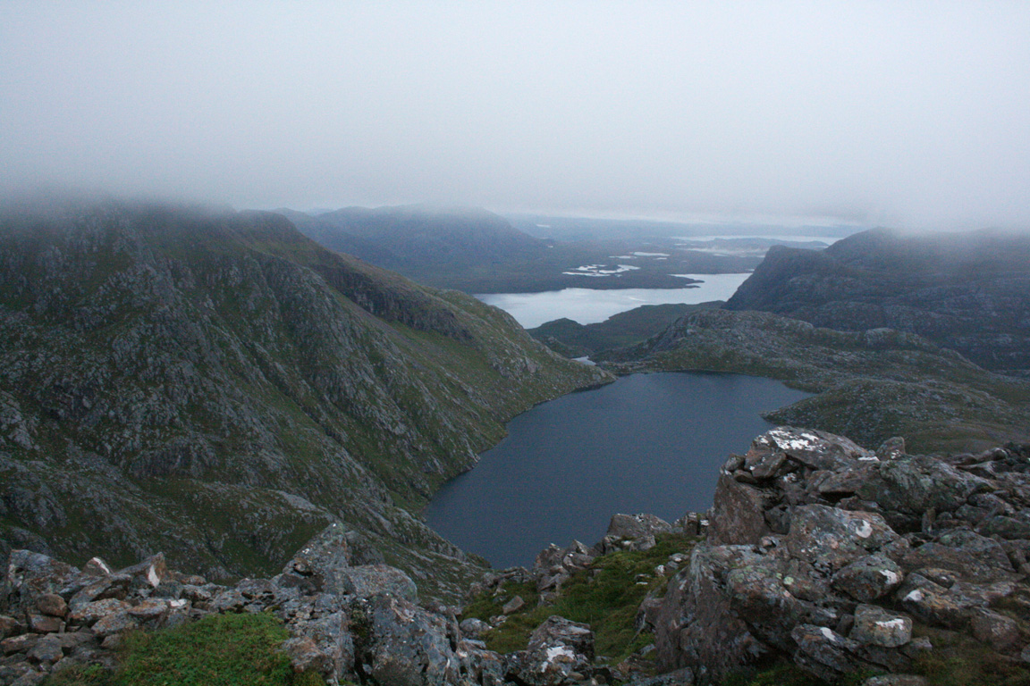
We climbed beneath the cloud, and I could tell that we were descending into a west facing corrie. At this point Michael and I had some disagreements as to where we were, but I could visualise the topography in my head. If I were right, we should be descending towards Fuar Loch Mor, but of course I couldn't see anything right now. The opposite side of the valley should have been Ruadh Stac Mor, but of course there were no views and very little to tell us where we were.
We had climbed past the steepest ground and we emerged out onto a flatter area of grass and bedrock. I was still convinced we were near Fuar Loch Mor, but the landscape revealed little to us. We walked down the corrie, following a stream until we came to what seemed to be a very large drop. And as I approached, it was a big one too - there was no ground in front of me anymore, just black empty space. I seemed to be walking towards the edge of a very large cliff and if so, it threw the loch idea out of the window - there were no dramatic drops around Fuar Loch Mor. I began to wonder where the hell must we be until I edged over a little more. Suddenly I saw the water edge just a metre beneath my feet and now there were no cliffs or dramatic drops. We'd found the loch.
So now we knew where we were, how should we proceed? There was a stalkers path perhaps 50 metres above the loch shore that contoured Ruadh Stac Mor. If we could find it, it would be easy sailing from there. Stalkers paths are well built and well represented on the OS maps. I climbed the hillside to find the path and Michael stayed by the lochside to see if he could find a stalkers path leading up from the lochside. We'd be a small distance apart, but we agreed not to go out of sight of each other.
I climbed up the bank and after about 50 metres, still couldn't find anything. I was still on steep ground, although didn't want to go out of sight of Michael either. From up here, he seemed to be some distance away. We continued to search with no results until the light from his head torch disappeared around a corner. And it didn't come back. I knew we couldn't get separated, so I stood on the hillside shouting Michael's name over and over. I didn't move from my spot, but just stood in the darkness and listened for signs. I wasn't sure what to do, and no one came. I considered what to do, still shouting when the glow of a headlamp appeared over the hillside alongside me.
It was Michael, and thank god for that...
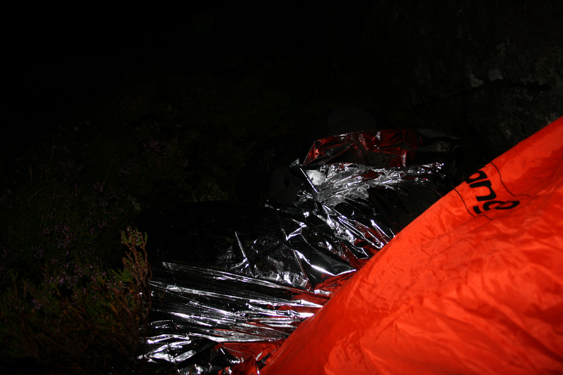
We changed tactics and went down to the lochside, where we could follow the outflow to the stalkers path. But down by the lochside, we were both tired and not on top form. We needed sleep and the night was almost windless and not too cold. We passed a boulder with a comfortable looking spot beside, and put down our rucksacks. We would bivouac here and wait until the light returned. I pulled out my bivouac bag, took my boots off for the night and positioned my rucksack to use as a sort of pillow. It was hardly ideal but once inside, I felt relatively comfortable, and able to nod off to sleep. It was 1.50am and over three hours since we left A' Mhaighdean.
Ruadh Stac Mor
Michael awoke first, and was already up and about by the time I awoke at my alarm time of 4am. I didn't wait around either. I'd had a jacket zipped all the way up with a hat on, so the midges had an area across my eyes and nose to feast on. My bivvy bag was made of plastic so by the time I woke up, it was dripping with condensation inside. I would have been drenched too had I not been wearing waterproofs. Last of all, I was very cold and shaking violently when I woke up. It was time time to get going so I packed away and joined Michael on the slopes above.
I'd had only two hours sleep, but it made the world of difference. And as the day dawned, the mountains were clear of cloud. A' Mhaighdean and Ruadh Stac Mor were right in front of us. It now seemed odd to have made such a fuss in the dark since we could see so clearly now. We climbed up the side of Ruadh Stac Mor where we came upon a stalkers path - well built and well defined. It was all so obvious now, and since the hills were clear of cloud, we decided to go for Ruadh Stac Mor's summit, the final of the six Fisherfield Munros. We dumped the rucksacks by the path and went on our way.

We ascended the scree slopes at the northern end of the hill and while Michael made a steep ascent on rock, I contoured further east and climbed a steep gully of grass and scree. It was a very exhilarating scramble, but on exceptionally loose ground where a fall would have been bad news. I was shovelling the scree down sections I was yet to climb just to clear up the route and when I emerged at the top, I was more than happy to be done. Michael appeared a minute later and told me of his equally exhilarating climb.


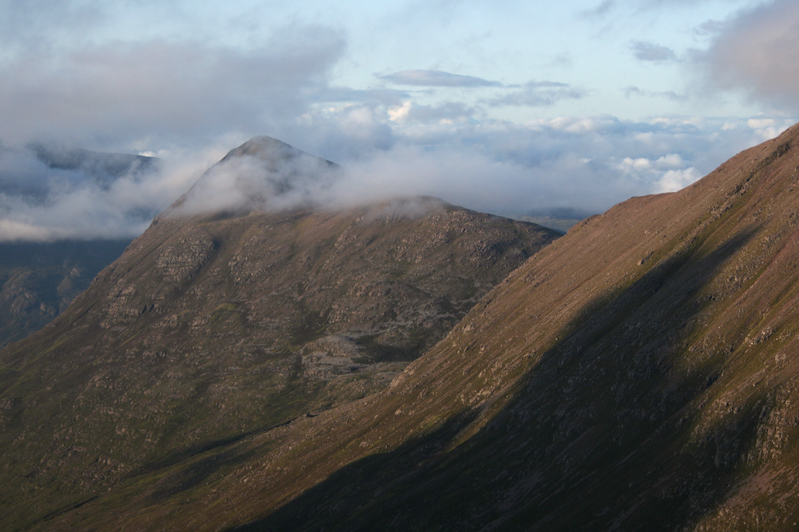
To the north the clouds glowed red with the sunrise, but it wasn't to last and today we'd only see cloud blanketing the sky. From where we stood, we'd have a walk just short of a kilometre to gain Ruadh Stac Mor's summit. Following a brief walk up the mountains spine, we arrived there at 5.50am. Cloud was now covering many of the Munro summits, so we didn't stay long and were on our way after five minutes. But now we'd climbed the Fisherfield Six, a group of Munros I didn't think in a million years I'd do so soon.
Now for the long walk back...
Descent from Ruadh Stac Mor, to Shenavall then Dundonnell
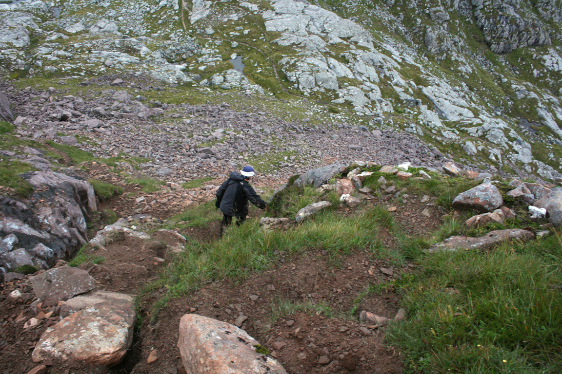
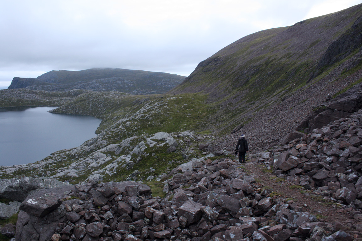
We took the short, sharp route off Ruadh Stac Mor by following the path southwest to Poll Eadar dha Stac, the bealach above Fuar Loch Mor. We headed north along the path to collect the rucksacks, then followed the path from there for the long kilometres back to Shenavall. It was going to be a long way.
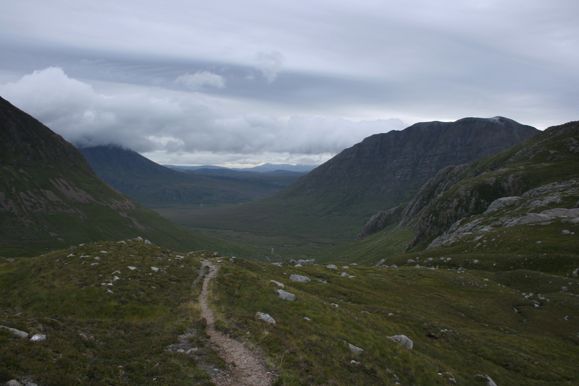
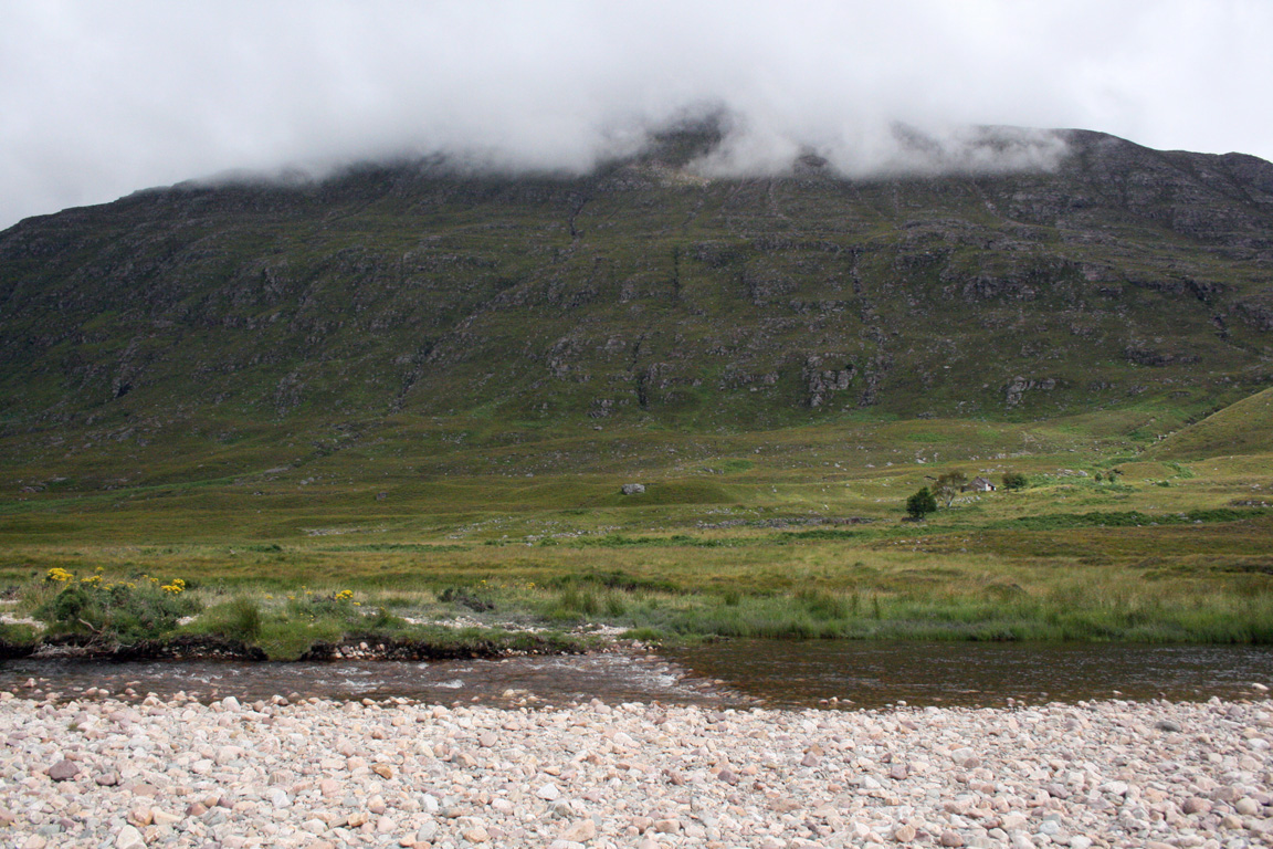
We walked north for about a kilometre before turning right at a junction to head in the direction of Gleann na Muice Beag. The path then descended into this glen, and then emerged out on Gleann na Muice. Beinn Dearg Mor was always above us, standing with magnificent stature and An Teallach was making an appearance today too. We walked north up Gleann na Muice as far as Larachantivore, where we crossed the Abhainn Gleann na Muice (again, without taking boots off) and then crossing the very boggy ground in the direction of Shenavall. Rain was starting to fall, but for now it was just spots and we crossed the Abhainn Strath na Sealga, arriving back at Shenavall at 10.35am. It had taken quite some hours to arrive here from Ruadh Stac Mor, but this leg of the walk had probably been the least memorable.


Once at Shenavall, I pulled out the sleeping bag and met I'd left there the day before, and spread it by the fire which we lit to dry boots and socks. I didn't wake up for several hours and got a comfortable sleep on the floor. It was also a chance to dry my feet off, for they'd been in wet boots for many hours. When Michael and I woke up, a family of four arrived with their two dogs, and we packed away our gear, aiming to get back to the van within the next couple of hours.
We finally got moving at 3.20pm, and climbed up the path from Shenavall onto the moors above. The weather was fairly calm when we left, but the wind picked up and the rain began to fall very heavily in large droplets that would have left us soaked in no time if it hadn't been for our waterproofs. My rucksack (with all the camping gear on the outside) had no waterproof cover, so the contents got fairly wet.


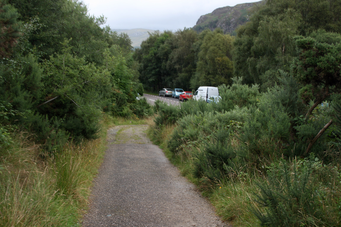
The weather battered us all the way up to where we met back with the track but eased with time. The urge to get back to the van was strong, and we descended into Gleann Chaorachain where we finally met with the van at 6.20pm three hours after leaving Shenavall. We drove to Ullapool, firstly to enquire about a room at The Ceilidh Place Hotel, but they were fully booked. We had dinner at The Arches (macaroni cheese and chips would do me) before heading off after 9pm, bound for Glasgow. Probably not the best idea.
We slept in the van multiple times on the way down the A82 - two one hour breaks then a longer sleep lasting a few hours. Michael eventually dropped me home around 8am before heading home himself. It was absolutely wonderful to be home after such a trip, and I slept endlessly. I'd also picked up some kind of bug on the way from Ullapool to Glasgow, and this put me in bed for a few days. I believe this was mixed with exhaustion, but I can't be sure.
Still, it was such a wonderful trip. In total, Michael and I climbed ten Munros as well as an attempt on a Graham. (Stac Pollaidh) A big thanks to Michael for the company, and also to Martin and Michael Kerrigan during the Northern Highland Munros.
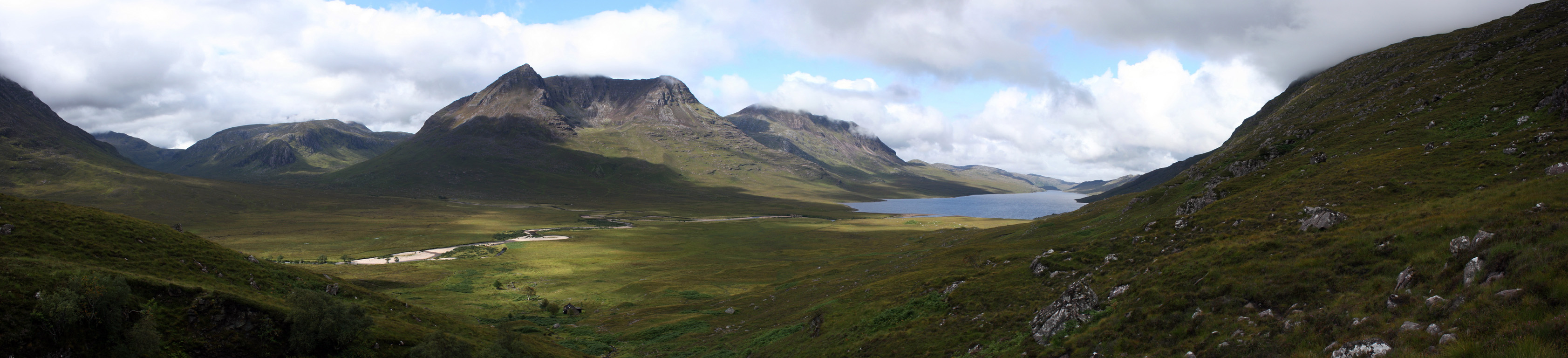
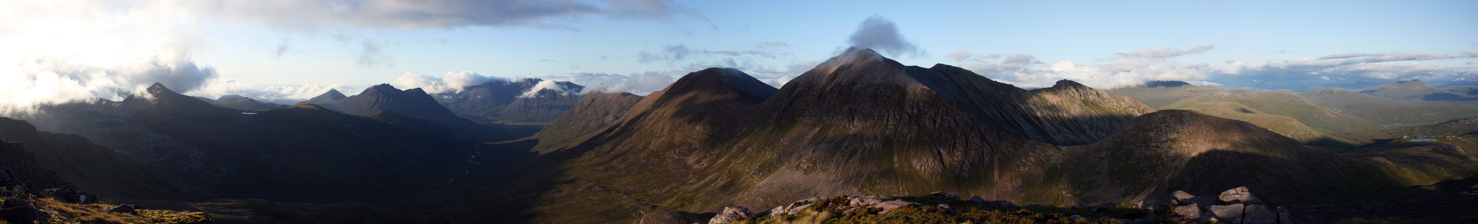
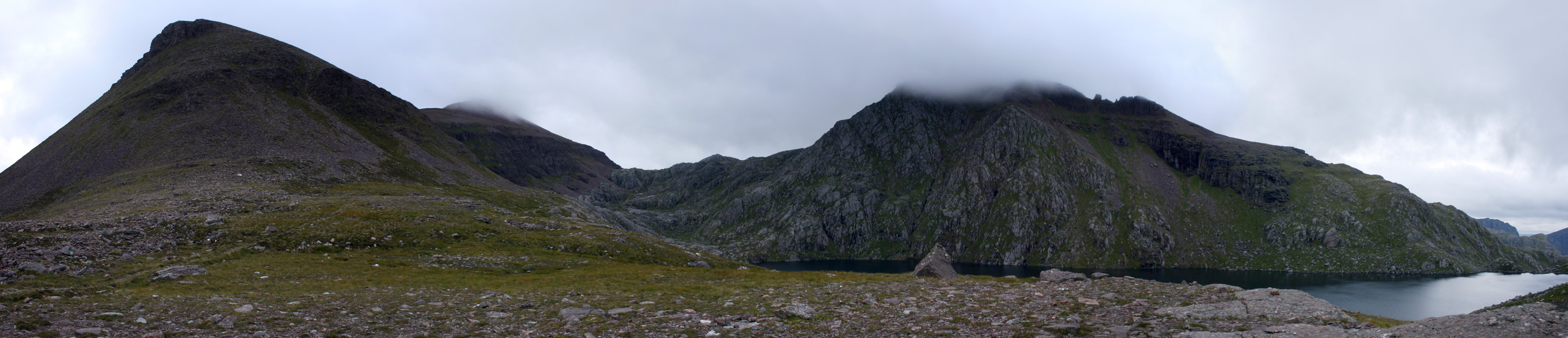
360˚ Panoramas

Beinn Tarsuinn

Ruadh Stac Mor
Times (Time relative to 0.00)
(0.00) 8.55am Dundonnell lay-by (10th)
(2.35) 11.30am Shenavall
(6.20) 3.15pm Beinn a' Chlaidheimh
(8.25) 5.20pm Sgurr Ban
(9.20) 6.15pm Mullach Coire Mhic Fhearchair
(10.05) 7.00pm Meall Garbh
(11.45) 8.40pm Beinn Tarsuinn
(13.45) 10.40pm A' Mhaighdean
(16.55) 1.50am Bivouac (start) (11th)
(19.05) 4.00am Bivouac (end)
(20.55) 5.50am Ruadh Stac Mor
(25.40) 10.35am Shenavall Bothy (arr.)
(30.25) 3.20pm Shenavall Bothy (dep.)
(33.25) 6.20pm Dundonnell Lay-by
Written: 2009-08-14